“The views expressed are those of the author and do not necessarily represent those of the National Weather Service.”
Please keep in mind the ESRL/PSD GSDM web link, below, while reading this discussion.
http://www.cdc.noaa.gov/map/clim/gsdm.composites.shtml
Please see links below for global SST details. Partially linked to the seasonal cycle, the warmest SSTs globally are across the equatorial
http://www.wmo.int/pages/prog/wcp/wcasp
http://iri.columbia.edu/climate/ENSO/currentinfo/technical.html
http://www.pmel.noaa.gov/tao/jsdisplay/
http://www.cdc.noaa.gov/forecast1/IndoPacific.frcst.html (note the initial projection)
http://www.cpc.ncep.noaa.gov/products/precip/CWlink/MJO/index.primjo.html (link 19)
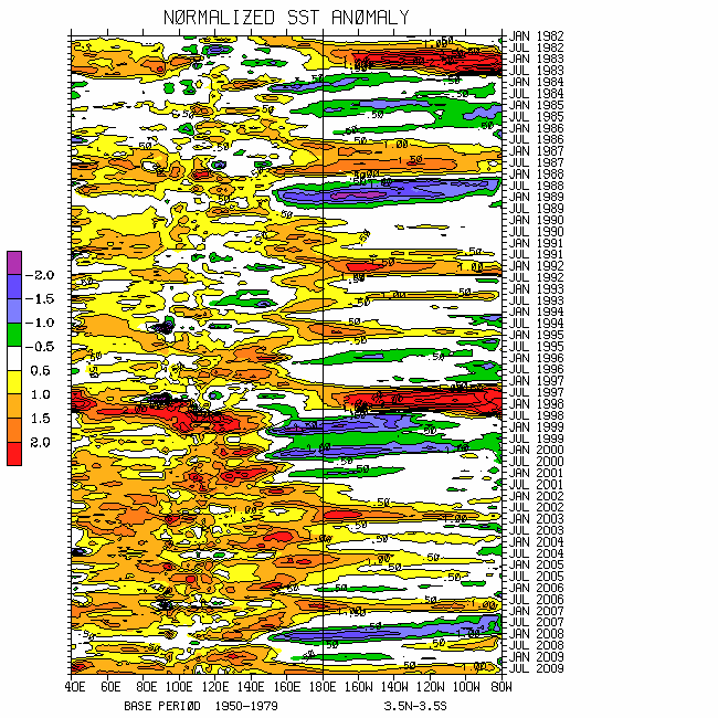
http://www.cdc.noaa.gov/map/images/sst/sst.long.time.io.gif
Per WH (2004) measure and other tools, the moist convective signal with the ongoing strong MJO is propagating through the
Moist tropical convective forcing has already propagated poleward off the equator across the west central Pacific, increasing the tropical cyclone hazard in the region of the
There continues to be the lack of a significant projection in phase space of the WB (2009) measure of the GWO (since ~1 April). Recall (again) that the GWO is a global dynamical measure of the atmosphere, whereas the WH (2004) empirical MJO measure only considers lower and upper tropospheric winds with OLR anomalies within 15 degrees of the equator. From the global perspective, there has been a weakening La-Nina allowing relative AAM to return to about normal per R1 data climatology. In fact, through 30 April relative tropospheric AAM is slightly above normal. Additionally, AAM tendencies have not been large (for reasons), all combining to give the appearance of a weak GWO signal.
However, zonal mean and regional scale GWO components, as well as individual terms of the earth-atmosphere AAM budget have been anything but weak. These include Eastern Hemisphere subtropical wave trains that excited the 2 (stochastically forced "cheap") MJOs in the region of
Regardless of details, a superposition of phase 7 for both the GWO and MJO snr 250mb psi composite anomaly plots best depicts the current global circulation. For example, there has been subtropical transition of
It is relatively clear to me that a GWO/MJO 7-8-1-2 transition is in progress (a.k.a. a low to high zonal eddy wave number transition response across the Northern Hemisphere extratropics). The corresponding snr 250mb psi composite anomaly plots should depict the expected synoptic behavior of the atmospheric circulation over the next few weeks. The probable response for other variables such as anomalous 2m air temperature across
Enhanced moist tropical convective forcing is likely to return to the
Appendix
All presentations from the 24 February 2009 GWO workshop are available via anonymous ftp. If you have not received information on how to retrieve these, let me know. There was excellent attendance at this day-long event, and feedback was strongly positive. We are working to mainstream this effort. The support is very much appreciated!
Links to CPC and PSD ENSO discussions, and a new experimental forecast technique involving a coupled LIM (3rd link below):
http://www.cpc.ncep.noaa.gov/products/analysis_monitoring/enso_advisory/index.shtml
http://www.cdc.noaa.gov/people/klaus.wolter/MEI/
http://www.cdc.noaa.gov/forecasts/clim/
The following are links to information about the stratosphere and other nice monitoring tools:
http://ds.data.jma.go.jp/tcc/tcc/products/clisys/index.html
http://code916.gsfc.nasa.gov/Data_services/met/ann_data.html (new stratosphere link!)
The following is a link to NCEP model verifications (surf around for lots more):
http://www.cpc.ncep.noaa.gov/schemm/z500ac_wk2_na.html
The following is a link discussing recent global weather and related events:
http://www.wmo.ch/pages/mediacentre/news/index_en.html
These are probabilistic statements. We hope that an opportunity will arise for us (soon) to allow our dedicated web page effort to mature, expediting objectively and accountability. This web page effort will hopefully include an objective predictive scheme for the GWO with hindcasts.
The WB (2007) paper on the GSDM has been published in the February issue of MWR. The first of a two-part paper, where WB formally introduce the GWO (WB (2009)), is (still) awaiting publication in MWR. An early on-line release can be downloaded from the following link:
http://ams.allenpress.com/archive/1520-0493/preprint/2008/pdf/10.1175_2008MWR2686.1.pdf
In addition to the subseasonal snr composite anomaly plots, we would like near real-time discussions with “weather maps” to become a routine part of the ESRL/PSD GSDM web site sometime soon. Part-2 of our GWO paper will discuss the latter. We want to emphasize notions such as global-zonal mean-regional scale linkages as well as forcing-response-feedback (with subsequent interactions) relationships. An important purpose is to provide a dynamical weather-climate linkage framework to evaluate the numerical models in a sophisticated manner as part of a complete subseasonal (and any time scale) forecast process, in addition to a climate service for all users. Relying on the numerical models alone is a cookbook, extremely unscientific, and makes Rex the Rottweiler VERY angry! I am planning on posting a discussion next weekend, 8-10 May.
Ed Berry
5 comments:
Someday I want to do the correct reading and understand all this. I hope I can ask a question of two a week and perhaps I will understand some before that. Here is my question: With low AAM, we are looking at highly meridional flow? High AAM is stronger than normal zonal flow?
Ed,
Well, it seems that the MJO triggered a welcomed round of wet weather from northern California northward over the last week+. With the MJO propogating eastward and then back into the Indian Ocean, do you still believe that progressive troughs will push across the west and central US sometime between late May and early June? Appears CPC is on board with this idea. I'm going from memory from your past blogs about expectations, so I hope I haven't misinterpreted! Thanks for your expertise! Brett
It has been interesting to see the MJO slow to a crawl then reverse. I wonder if the uptrend to higher pressure over Northern AU is a sign of at least a short term 'regime change' from low AAM dominated weather? Speculation seems rife about a Winter El Nino. I am skeptical .....
Hello sirvatka,
Sorry for my slow response. Please feel free to ask questions anytime. I do my best to get back.
Broadly, high (low) AAM is stronger (weaker) than normal global westerly wind flow, favoring a southward (northward) shifted storm track. Intense (weaker) zonal flows tend to dominate the (continents) oceans during high (low) AAM. Low (high) pressures tend to dominate the subtropics and even midlatitudes during high (low) AAM regimes. High (low) AAM is often characteristic of El-Nino (La-Nina).
During the last couple of years the atmosphere has generally been low AAM due to La-Nina. That is one reason for periods of excessive dryness across the southern USA.
Hope this helps,
Ed
Hello Brett and Captain Climate,
I am planning on doing a post tomorrow (5/9), so hopefully that will answer some of your questions. At this point I almost feel like "punting" given the mess our weather-climate situation has become along with my poor assessments.
Regardless, consolidation of tropical forcing should occur across the Eastern Hemisphere during the next few weeks and I would expect a large negative AAM tendency "soon". Perhaps by week-3 we will see a response depicted by snr phases 2-3 for the GWO with MJO phases 4-5 (OLR, PSI, etc).
Take care,
Ed
Post a Comment