“The views expressed are those of the author and do not necessarily represent those of the National Weather Service.”
Please keep in mind the ESRL/PSD GSDM web link, below, while reading this discussion.
http://www.cdc.noaa.gov/map/clim/gsdm.composites.shtml
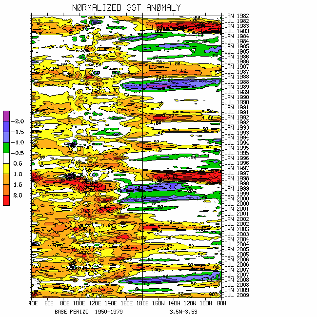
Please see links below for global SST details. There is little change in the spatial patterns from a week ago. The largest negative global tropical SST anomalies appear to be across the North Atlantic Ocean with magnitudes approaching 3C west of Africa. With varying amplitude, the latter have been persistent for at least the past 2-3 months. Slow warming of the convectively suppressed Indian Ocean continues, with totals approaching 30C.
Nino SSTs are generally near normal. Does this suggest La-Nina is “over”??? When thinking about this, please remember that ENSO is a global phenomenon involving the ocean-land-atmosphere dynamical system. ONI simply does not cut it!
http://www.wmo.int/pages/prog/wcp/wcasp/enso_update_latest.html
http://iri.columbia.edu/climate/ENSO/currentinfo/technical.html
http://www.pmel.noaa.gov/tao/jsdisplay/
http://www.cdc.noaa.gov/forecast1/IndoPacific.frcst.html (note the initial projection)
http://www.cpc.ncep.noaa.gov/products/precip/CWlink/MJO/index.primjo.html (link 19)
http://www.cdc.noaa.gov/map/images/sst/sst.long.time.io.gif
As has been the case during much of this past boreal 2008-09 cold season that I will remember as the “La-Nina from Hell”, weather-climate signals are once again conflicting and incredibly complicated. From intense daily monitoring and on-going work to better understand the scientific issues, my comfort level is okay with all this. However, this medium of communication is very inefficient, stressing the importance of brevity. The astute and learned readers will see matters intentionally not discussed.
Not surprisingly, the moist tropical convective forcing with our strong MJO, ~2.5 sigma projection in octant 5 of WH (2004) phase space retaining ENSO, has significantly slowed its eastward propagation. This is consistent with late January and mid-March, the former (latter) after (before) initiation. Full-disk satellite imagery shows the moist convective MJO signal centered ~0/150E extending from near the Philippines into the South Pacific Ocean. Unquestionably and with at least a two-week forecast lead time (see 11 April discussion, for example), this MJO working with extratropical dynamical processes has been impacting the USA. For instance, Rossby wave energy dispersions (RWDs) from the Eastern Hemisphere upper tropospheric anomalous twin anticyclones has contributed to the current digging western USA trough, and there is a subtropical jet across the southern states. A loose superposition of the 250mb snr psi composite anomaly plots for phase 2 of the WB (2009) measure of the GWO and phase 5 for the WH (2004) MJO depicts the ongoing global circulation.
There continues to be little projection in WB (2009) GWO phase space. However, fast time scale processes such as the RWDs discussed above are a component of the GWO. In fact, 250mb circulation wind anomalies have been ~30-50m/s with these features. The weak projection is one ramification of the GWO being a global dynamical circulation measure, and that itself may be a quantification of conflicting weather-climate signals (in this case). However, excursions understood, there has been a clear shift of the GWO along the La-Nina attractor “upward” in phase space. That is, there have been stochastic dynamical processes working to add westerly wind flows to the subtropical atmospheres. This movement has been displaced toward octants 3-5 of GWO phase space, suggestive of a weakening La-Nina.
Updated through 22 April, tropospheric global relative AAM has spiked too slightly above the R1 data climatology. Above normal AAM has not been observed since at least early December 2008. I do think some additional increase is possible in the near term. The punch line is that we are not out of the “bear atmosphere” yet, analogous to the financial markets. Sparing details, there is already subtle evidence our La-Nina base state is attempting to reload. For example, with symmetry anomalous ridges dominate the extratropics of both hemispheres, characteristic of the all too familiar positive phase of the Branstator (2002) circumglobal teleconnection.
Per Wolter (personal communication), La-Nina impacts tend to be less severe during April. Just as stochastic (GWO) forcing gave us the on-going (cheap but strong) MJO which has contributed to the “blessed precipitation” across many previously dry areas across the country, the subtropical westerly wind flow anomalies may be “taken away”. I will be carefully monitoring all aspects of the global and zonal mean terms of the earth-atmosphere AAM budget UFN (components of the GWO). Stay tuned.
In the meantime, during weeks 1 and 2 tropical forcing should become well established across the Western Hemisphere, only to propagate back into what may be a very warm Indian Ocean by roughly weeks 3-4. For simplicity, the superposition of the snr plots discussed above is okay through roughly days 5-7. I think the notion of a 7-8-1-2 transition depicted by both the GWO and MJO 250mb snr psi (and other variables) composite anomaly plots is still the best forecast solution for ~weeks 2-3. During mid-late May the global circulation may be represented by superposition of GWO phases 2-3 with MJO phases 4-5 should Eastern Hemisphere tropical convective forcing intensify.
For the USA, after the week-1 western trough, an extended north Pacific Ocean jet/split flow pattern of western troughs, closed cyclones/downstream southeast states ridge scenario is reasonable ~weeks 2-3 (already offered previously). The latter will be shifting slowly north with the seasonal cycle. Mid-late May heading into June could see a resumption of more full-latitude progressive western and central states troughs, focusing the emphasis for anomalous precipitation and severe local storms across the Northern Plains and Upper Mississippi Valley. Other weather impacts, nationally and internationally, should be understood.
Appendix
All presentations from the 24 February 2009 GWO workshop are available via anonymous ftp. If you have not received information on how to retrieve these, let me know. There was excellent attendance at this day-long event, and feedback was strongly positive. We are working to mainstream this effort. The support is very much appreciated!
Links to CPC and PSD ENSO discussions, and a new experimental forecast technique involving a coupled LIM (3rd link below):
http://www.cpc.ncep.noaa.gov/products/analysis_monitoring/enso_advisory/index.shtml
http://www.cdc.noaa.gov/people/klaus.wolter/MEI/
http://www.cdc.noaa.gov/forecasts/clim/
The following are links to information about the stratosphere and other nice monitoring tools:
http://ds.data.jma.go.jp/tcc/tcc/products/clisys/index.html
http://code916.gsfc.nasa.gov/Data_services/met/ann_data.html (new stratosphere link!)
The following is a link to NCEP model verifications (surf around for lots more):
http://www.cpc.ncep.noaa.gov/schemm/z500ac_wk2_na.html
The following is a link discussing recent global weather and related events:
http://www.wmo.ch/pages/mediacentre/news/index_en.html
These are probabilistic statements. We hope that an opportunity will arise for us (soon) to allow our dedicated web page effort to mature, expediting objectively and accountability. This web page effort will hopefully include an objective predictive scheme for the GWO with hindcasts.
The WB (2007) paper on the GSDM has been published in the February issue of MWR. The first of a two-part paper, where WB formally introduce the GWO (WB (2009)), is (still) awaiting publication in MWR. An early on-line release can be downloaded from the following link:
http://ams.allenpress.com/archive/1520-0493/preprint/2008/pdf/10.1175_2008MWR2686.1.pdf
In addition to the subseasonal snr composite anomaly plots, we would like near real-time discussions with “weather maps” to become a routine part of the ESRL/PSD GSDM web site sometime soon. Part-2 of our GWO paper will discuss the latter. We want to emphasize notions such as global-zonal mean-regional scale linkages as well as forcing-response-feedback (with subsequent interactions) relationships. An important purpose is to provide a dynamical weather-climate linkage framework to evaluate the numerical models in a sophisticated manner as part of a subseasonal (and any time scale) forecast process, in addition to a climate service for all users. Relying on the numerical models alone is a cookbook, extremely unscientific, and makes Rex the Rottweiler VERY angry! I am planning on posting a discussion next weekend, 1-3 May.
Ed Berry
No comments:
Post a Comment