“The views expressed are those of the author and do not necessarily represent those of the National Weather Service.”
Please keep in mind the ESRL/PSD GSDM web link, below, while reading this discussion.
http://www.cdc.noaa.gov/map/clim/gsdm.composites.shtml
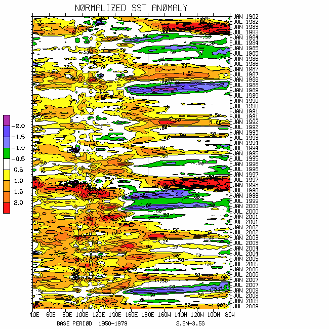
Please see links below for global SST details. There have been a few notable variations during the last few weeks. For instance, in contrast to about a year ago, equatorial Pacific Ocean SSTs have been cooling from the west coast of South America to ~120W, with anomalies ~minus 1-2C extending to depths of at least 100m. There has also been some warming from the far west central into the southwest Pacific, with anomalies ~plus 1-2C and totals approaching 30C. While weakened, the negative PDO signal is still present.
Overall, this is the time of year when the annual cycle of tropical ocean SSTs may be the most important in terms of ENSO. Whether or not the equatorial east Pacific Ocean cooling is "telling us something ", is unclear. Regardless, in my view the global atmosphere has generally been leading the Nino SSTs (including the official ONI) since at least December 2006. As discussed below, the La-Nina characteristics of the atmosphere remain well established. Variations understood (ex., 2007-08 and other events); at this point I would be surprised if I am not typing about La-Nina circulation issues a year from now (hopefully in a much better main streamed graphical medium than these discussions!).
http://www.wmo.int/pages/prog/wcp/wcasp/enso_update_latest.html
http://iri.columbia.edu/climate/ENSO/currentinfo/technical.html
http://iri.columbia.edu/climate/ENSO/currentinfo/technical.html
http://www.cdc.noaa.gov/forecast1/IndoPacific.frcst.html (note the initial projection)
http://www.cpc.ncep.noaa.gov/products/precip/CWlink/MJO/index.primjo.html (link 19)
http://www.cdc.noaa.gov/map/images/sst/sst.long.time.io.gif
From the global ocean-land-atmosphere dynamical system perspective, our quasi-stationary La-Nina circulation base state is quite pronounced and probable to persist “until further notice (UFN)”. However, the subseasonal component interfacing weather and climate is about as complicated as it can get. While I do feel relatively comfortable about the details about the dynamical processes involved (within the WB (2009) GWO framework), and confident about the probable synoptic variations for at least the next several weeks, it is a challenge to write about. Obviously, transition seasons add difficulty. I am only going to “broad-brush”.
Enhanced tropical convective forcing is occurring across multiple regions of the globe. The most important tied to La-Nina is the area centered ~0/140E, extending from the far eastern Indian Ocean into the southwest Pacific. Generally diurnal convection continues across northern South America, and rainfall is anomalously intense over equatorial and South Africa. Rigorous daily monitoring of rapid baroclinic wave packets/zonally oriented Rossby wave energy dispersions (RWDs) interacting with tropics tells me the Western Hemisphere tropical signal was forced by the extratropics. In fact, through 13 March a greater than 1 sigma MJO projection was depicted in octant 8 of WH (2004) phase space (removing ENSO). In some sense, one can argue that there is a weak “GWO driven MJO”.
Coherent modes Hovmollers and other tools suggest the “140E tropical forcing” is drifting slowly west. Similar to many events earlier this year, a convectively coupled Rossby mode may be contributing to the westward movement. I do think there will be consolidation of this convection with the eastward propagating Western Hemisphere signal in the region of ~100-120E during the next couple of weeks. For reasons, I suspect much of the western and central equatorial Indian Ocean will again be “by passed”. The consolidation will help to maintain/reload La-Nina.
Through 12 March, while tilted toward the La-Nina attractor, there is only a weak projection on the WB (2009) measure of the GWO. Does this mean there is little information to be gained from it? The astute reader will answer, “absolutely not!” Once again there is a “La-Nina equilibrium of sorts” involving various time evolving components of the earth-atmosphere AAM budget (see plots) forcing a weak projection (for now).
For the last ~30 days a large GWO variation of roughly 3 sigma involving first eddy poleward AAM transports then strong surface torques worked to add westerly wind flow to the global atmosphere. Zonal mean contributions of anomalous westerly wind flow were ~10N and ~45N (responses in the Southern Hemisphere were much weaker). The former led to a sickly looking subtropical jet (STJ) into the southern USA (did bring needed precipitation to Texas) and latter a northward shift of the zonal mean storm track. However, intense anomalous zonal mean easterly wind flow also shifted poleward to ~30N, having weekly means ~12m/s. So, once again, anomalous midlatitude ridges are present across the Northern Hemisphere extratropics, similar to the positive phase of a Branstator (2002) circumglobal teleconnection. Phase 2 of the GWO 250mb snr psi composite anomaly plots loosely depict the global circulation, especially the extratropics.
Overall, like that seen during the 2007-08, and typed so many times this cold season, there is nice interhemispheric (mainly northern; austral warm season) meridional symmetry of zonal mean zonal wind anomalies. Furthermore, consistent with the tropical forcing, animations of upper tropospheric daily mean vector wind anomalies do suggest the Indian Ocean (west Pacific Ocean) anticyclones (cyclones) are in the process of getting reestablished. Phase 4 of the MJO snr 250mb psi composite anomaly plots best depicts tropical circulation anomalies. In general, with variations, phases 4-5 of these MJO composites may best represent the tropics UFN.
The whole above spiel simply tells us the global circulation is “classic La-Nina”, and is probable to continue, again, UFN. I do expect the GWO to resume its orbit in phase space, roughly octants 1 to 4 then back with periods perhaps ~20-30 days. Similar to a year ago, these orbits may spiral upward. However, an important difference between this boreal winter and last year is the lack of relatively robust slower subseasonal variations including MJOs compared to a year ago.
Utilizing the GWO and MJO snr composites for ~week 1-4 predictions may be quite challenging in these hard times. This is where “Rottweiler experience and understanding of this stuff” is needed. Loosely, focusing on the lower 48 states, I think we are going to continue seeing synoptic alternations between east Pacific Ocean troughs/western and central states ridges/east coast troughs with western troughs and southeast states ridges. The latter may become preferred heading through spring (was a year ago with the subseasonal activity), and the storm track is probable to remain shifted north.
Weather ramifications are understood, including the likelihood and expansion of worsening drought conditions (rangeland wildfires, dust storms, etc.) across the central and southern High Plains. If any “miracles” can happen (ex., resumption of MJOs) and stronger STJs can be directed into the USA Desert Southwest, that will help to mitigate at least some of the dryness. The latter could also help other parts of the country experiencing drought. The Pacific Northwest is likely to remain excessively wet for at least the next 2-4 weeks.
I trust the expertise of the appropriate meteorological agencies to alert the public of additional weather hazards worldwide. An elevated risk of tropical cyclones is probable perhaps both sides of the equator in the region of Indonesia and northern Australia weeks 1-2. In fact, that concern may focus from the northeast coast of Australia into the region of the South Pacific islands, given warm SSTs, weakly anomalous surface westerly winds and other reasons.
Appendix
All presentations from the 24 February 2009 GWO workshop are available via anonymous ftp. If you have not received information on how to retrieve these, let me know. There was excellent attendance at this day-long event, and feedback was strongly positive. We appreciate all the support!
Links to CPC and PSD ENSO discussions, and a new experimental forecast technique involving a coupled LIM (3rd link below):
http://www.cpc.ncep.noaa.gov/products/analysis_monitoring/enso_advisory/index.shtml
http://www.cdc.noaa.gov/people/klaus.wolter/MEI/
http://www.cdc.noaa.gov/forecasts/clim/
The following are links to information about the stratosphere and other nice monitoring tools:
http://ds.data.jma.go.jp/tcc/tcc/products/clisys/index.html
http://code916.gsfc.nasa.gov/Data_services/met/ann_data.html (new stratosphere link!)
The following is a link to NCEP model verifications (surf around for lots more)
http://www.cpc.ncep.noaa.gov/schemm/z500ac_wk2_na.html
The following is a link discussing recent global weather and related events:
http://www.wmo.ch/pages/mediacentre/news/index_en.html
These are probabilistic statements. We hope that an opportunity will arise for us (soon) to allow our dedicated web page effort to mature, expediting objectively and accountability. This web page effort will hopefully include an objective predictive scheme for the GWO with hindcasts.
The WB (2007) paper on the GSDM has been published in the February issue of MWR. The first of a two-part paper, where WB formally introduce the GWO (WB (2009)), is (still) awaiting publication in MWR. A pdf of an in press version can be downloaded from the following link:
http://www.cdc.noaa.gov/map/clim/wb08_revised_final.pdf
In addition to the subseasonal snr composite anomaly plots, we would like near real-time discussions with “weather maps” to become a routine part of the ESRL/PSD GSDM web site sometime soon. Part-2 of our GWO paper will discuss the latter. We want to emphasize notions such as global-zonal mean-regional scale linkages as well as forcing-response-feedback (with subsequent interactions) relationships. An important purpose is to provide a dynamical weather-climate linkage framework to evaluate the numerical models in a sophisticated manner as part of a subseasonal (and any time scale) forecast process, in addition to a climate service for all users. Relying on the numerical models alone is a cookbook, extremely unscientific, and makes the Rottweiler VERY angry!
I will not be able to post another discussion until the weekend of 27-29 March due to covering operational overnight shifts. It may just be the “same atmosphere different day (SADD)” anyway!
Ed Berry
2 comments:
It seems that popular 'mainstream' opinion is to jump on the El Nino bandwagon without a mechanism to get us there. If I can growl a little bit on behalf of your Rottweiler ... saying "it is time for an El Nino" is not good enough for me.
Thanks for standing your ground and sharing actual data and your analysis with us. Unless the mechanism for cooling stops or extratropical forces combine to induce a longer term countertrend rally than what we have seen ... then pure scientific method (null hypothesis) would lead us first to a La Nina/Low AAM regime is in a reloading phase.
It will be interesting to see if Redoubt blows or other variables introduce exciting variations to the global circulation.
Thanks always Ed!
Hi Captain Climate,
You are welcome, and thank you for the comment! I agree with your thoughts.
There is little evidence of an evolution toward El-Nino. The weather-climate situation is a mess; however, global relative AAM is low and decreasing. That suggests dynamical processes are working to maintain La-Nina, especially in the presence of the seasonal cycle. I will try to get a complete discussion out next weekend after I am done covering these overnight shifts.
Regards,
Ed
Post a Comment