“The views expressed are those of the author and do not necessarily represent those of the National Weather Service.”
Please keep in mind the ESRL/PSD GSDM web link, below, while reading this discussion.
http://www.cdc.noaa.gov/map/clim/gsdm.composites.shtml
There is little change to the spatial pattern of global SSTs from a week ago. An earlier trade wind surge across the west central
One of the many ENSO issues includes the magnitude of (any) additional warming across the west
http://www.wmo.int/pages/prog/wcp/wcasp/enso_update_latest.html
http://iri.columbia.edu/climate/ENSO/currentinfo/technical.html
http://www.pmel.noaa.gov/tao/jsdisplay/
http://www.cdc.noaa.gov/forecast1/IndoPacific.frcst.html (note the initial projection)
http://www.cpc.ncep.noaa.gov/products/precip/CWlink/MJO/index.primjo.html (link 19)
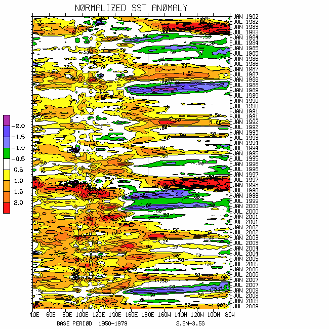
http://www.cdc.noaa.gov/map/images/sst/sst.long.time.io.gif
There is also no change to the painful complexity, including the harsh reality that now is not a good time to be making weather predictions. Tropical convective forcing remains most intense across the
The combination of the winds and convective signals has led to a resurgent MJO signal in WH (2004) phase space, having ~1.5 sigma projection in octant 7 (through 22 May) and somewhat weaker in octant 6 retaining ENSO. The “loop scenario” offered in my 16 May discussion worked out. Phase 6 of the 250mb MJO snr psi composite anomaly plots best describes tropical and even a few extratropical circulation anomalies. My thought has been for this signal to persist in octants 6-8 for a while. However, there may start to be cancellation between the 2 regions mentioned above. Regardless of the projection, I still do expect a signal of tropical forcing to propagate through the
Tropical-extratropical interactions including the MJO and dynamical processes explained by the WB (2009) measure of the GWO have worked to create a recent respectable positive global wind tendency. Through 21 May global AAM tendency was ~plus 20 Hadleys having large zonal mean contributions from the equatorial and subtropical atmospheres. In fact, latest 250mb weekly means are ~3-4m/s. However, albeit shifted northward, 250mb weekly averaged zonal mean easterly wind flow anomalies are ~10m/s around 45-50N, strongly bearish.
Forced by AAM transports (see plots), those poleward and downward propagating anomalous zonal mean easterly wind flows have increased global and zonal mean mountain and frictional torques during the past 7-10 days. That has also contributed to the recent increase in global westerly wind flow with relative AAM near the R1 data climatology. The point from this untangling of the earth-atmosphere AAM budget is that there is finally a greater than 1 sigma projection of the GWO. Through 21 May the signal was in octant 4-5 of phase space. However, I am not at all confident there will be the nice GWO variations in the near future like observed during this past boreal cold season. There may be a weak orbit towards octants 7-8-1; however, hanging around toward phases 3-5 UFN appears probable (weak La-Nina). Phase 4 of the GWO 250mb snr psi composite anomaly plot reasonably describes the current global atmosphere.
Synoptic responses during the past week or so included the zonal mean storm track shifted anomalously poleward over the Northern Hemisphere, continuation of anomalous extratropical ridges (both hemispheres) with low pressure across the subtropics, and Western Hemisphere subtropical jets. Cutting to the chase, I do expect the latter to shift poleward and bring the Northern Hemisphere storm track southward (including the lower 48 states) over the next 2-3 weeks. During roughly days 10-20 a couple of strong progressive troughs across the western into the central states (north of ~35-40 degrees) is still possible should there be some form of GWO 7-8-1 transition. Maybe there is still some hope for project VORTEX!
I am continuing the notion I have had since mid-April about the average synoptic pattern across the
Appendix
All presentations from the 24 February 2009 GWO workshop are available via anonymous ftp. If you have not received information on how to retrieve these, let me know. There was excellent attendance at this day-long event, and feedback was strongly positive. We are working HARD to mainstream this effort. The support is very much appreciated!
Links to CPC and PSD ENSO discussions, and a new experimental forecast technique involving a coupled LIM (3rd link below):
http://www.cpc.ncep.noaa.gov/products/analysis_monitoring/enso_advisory/index.shtml
http://www.cdc.noaa.gov/people/klaus.wolter/MEI/
http://www.cdc.noaa.gov/forecasts/clim/
The following are links to information about the stratosphere and other nice monitoring tools:
http://ds.data.jma.go.jp/tcc/tcc/products/clisys/index.html
http://code916.gsfc.nasa.gov/Data_services/met/ann_data.html (new stratosphere link!)
The following is a link to NCEP model verifications (surf around for lots more):
http://www.cpc.ncep.noaa.gov/schemm/z500ac_wk2_na.html
The following is a link discussing recent global weather and related events:
http://www.wmo.ch/pages/mediacentre/news/index_en.html
These are probabilistic statements. We hope that an opportunity will arise for us (soon) to allow our dedicated web page effort to mature, expediting objectively and accountability. This web page effort will hopefully include an objective predictive scheme for the GWO with hindcasts.
The WB (2007) paper on the GSDM has been published in the February issue of MWR. The first of a two-part paper, where WB formally introduce the GWO (WB (2009)), is (still) awaiting publication in MWR. An early on-line release can be downloaded from the following link:
http://ams.allenpress.com/archive/1520-0493/preprint/2008/pdf/10.1175_2008MWR2686.1.pdf
In addition to the subseasonal snr composite anomaly plots, we would like near real-time discussions with “weather maps” to become a routine part of the ESRL/PSD GSDM web site sometime soon. Part-2 of our GWO paper will discuss the latter. We want to emphasize notions such as global-zonal mean-regional scale linkages as well as forcing-response-feedback (with subsequent interactions) relationships. An important purpose is to provide a dynamical weather-climate linkage framework to evaluate the numerical models in a sophisticated manner as part of a complete subseasonal (and any time scale) forecast process, in addition to a climate service for all users. Relying on the numerical models alone is a cookbook, extremely unscientific, and makes Rex the Rottweiler VERY angry! I will not be able to do a complete discussion until the weekend of 5-7 June. Anyway, I need a break from all this atmospheric madness!
Ed Berry
4 comments:
Hello Ed,
If there was to be cooling in the west Pacifc Ocean and if the convective forcing in the BB was to die down, how much more would it take for you to consider El-Nino a possibility for this upcoming winter?
How does propogating easterly wind flow from 45-50N lead to an increase in global westerly wind flow?
To me the aspect of JJA being dominated by ridges on the coasts is exciting.
Hello Greg,
First, if you want an El-Nino, a warm west Pacific Ocean is a good thing. For ex., wwbs with tropical forcing could excite downwelling oceanic Kelvin waves to warm the entire basin. My concern is should EH tropical forcing continue to dominate especially this fall, trade surges may lead to cooling perhaps similar to 2008. We will have to monitor all this.
Much of the increase in global westerly wind flow has come from the equatorial/subtropical regions. Zonal mean anomalous easterlies have been propagating poleward as a response. See AAM plots, especially
http://www.cdc.noaa.gov/map/images/reanalysis/aam_total/glaam.sig.90day.gif
Think of the warm (cool) colors as westerlies (easterlies).
Hope this helps,
Ed
Thank you for the response.
So, you are concerned with the whole "what goes up must come down" aspect of the convective forcing. They could cause the warming of the west Pacific, but if they last too long, there could be a strong response cooling off the west Pacific.
Looking at the link you posted, I can see that from mid- April until recently that the easterly winds have been moving towards the poles. I see what you are saying with the poleward propogation of easterlies.
Hello Greg,
That is one way of putting it. An important issue is to build up heat content. Right now conditions across the eq. west Pacific are favorable. Convection is minimal and the trades are weaker than normal. Should the trades strengthen responding to enhanced convection farther west (ex., N. IO, active monsoon systems, etc.), that may offset warming. Regardless, we need to monitor. Compared to a year ago, an El-Nino (at least early stages) is more probable for 2009-10.
Ed
Post a Comment