We continue to work on our next weather-climate discussion for the ESRL/PSD MJO international web site, at
http://www.cdc.noaa.gov/MJO/Forecasts/climate_discussions.html
The following is taken from a draft of Section 2 of these discussions called “Predictive Insights”, with some wording changes to reflect the most updated information. We hope to have our latest discussion posted this upcoming week.
SSTAs across most of the central and east equatorial Pacific are within .5 deg C of normal, with SSTs ranging from ~26C near 100W to 29C and warmer just west and southwest of the date line. SSTs of 29C and higher also extend from the southwest Pacific into the IO. At depth, anomalies around plus 1-2C extend from 50-250m east-west along the equatorial cold tongue, meaning a slightly deeper than normal oceanic thermocline. SSTAs from the IO into the west Pacific are at least plus .5-1C, with the Pacific horseshoe experiencing ~ plus 1-2C. The Caribbean into much of the NTA also has SSTAs ~plus 1-2C. Latest prediction from CPC expects ENSO-neutral conditions to prevail during the next 3-6 months (see latest TAO data here, ESRL/PSD data here). The following are links to ENSO discussions.
http://www.cdc.noaa.gov/people/klaus.wolter/MEI/
http://www.cpc.ncep.noaa.gov/products/analysis_monitoring/enso_advisory/index.html
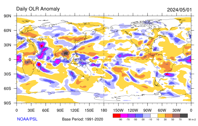
At this time the signal from the MJO is weak with the upper tropospheric divergent response moving through the WH, centered on the Atlantic Ocean. Satellite imagery (eastern hemisphere, full-disk east Pacific, full-disk west Pacific, full-disk Indian Ocean, full-disk Africa; other images available here) has enhanced convection extending from the east Pacific ITCZ across tropical South America and into especially central Africa. Tropical convection is less organized from the west Pacific toward southeast Asia (with the important exception of Typhoon Chanchu; see here). There are sporadic flare-ups across the warm South Pacific SSTs east of the date line in association with Southern Hemisphere (SH) baroclinic wave activity and associated front. Suppression continues to exist across most of the IO and has been extending eastward into most of Australia (latest 3-day averages of OLR total and anomalies here; latest 7-day average here; additional olr plots here). However, satellite imagery does show tropical convection slowly starting to increase across much of the IO during the last couple of days.
Statistical and numerical models of the MJO (see MJO forecasts, Additional MJO tools and forecasts) generally support the notion of enhanced convection returning to the Indian Ocean from tropical Africa by the start of week 2, with suppression across most of Indonesia. SSTs have also remain slightly above average across portions of the central and southern Indian Ocean (~+ 1-2C), which can be a precursor to a re-emerging MJO into the EH. Finally, SSTs also remain ~ plus 1-2C above normal across the tropical southwest Pacific, as well as the subtropical North and South Pacific and Atlantic Oceans. These basins will also contribute tropical convective forcing at times (plot of weekly global SSTAs here). The following are additional MJO monitoring tools:
http://www.cdc.noaa.gov/map/clim/olr_modes/
http://www.bom.gov.au/bmrc/clfor/cfstaff/matw/maproom/RMM/index.htm
http://www.cpc.ncep.noaa.gov/products/precip/CWlink/MJO/mjo.shtml
Monitoring suggests the WH will come back around into the IO from Africa in about a week, and contribute to possibly intense forcing in that region. Tropical convection may also become quite enhanced across the west Pacific during the next 1-2 weeks, with a possible consolidation ~ 120-140E during week 3. The seasonal cycle will play a role to whatever evolutionary route the tropical convective forcing takes during the next few weeks.
Since April 28th the interplay between SSTs, tropical convective forcing and circulation response-feedbacks has transitioned to a current situation best described by GSDM Stage 3. There has been an increase of zonal mean westerly flow throughout the tropical and subtropical atmospheres with anomalies ~5-10 m/s. While much of the downward and poleward propagation of these westerlies has been into the SH, some of this anomalous flow has gone through Africa into central Asia. Working with processes in the northern extratropics such as baroclinic wave packets interacting with north-south mountain ranges, these anomalous westerlies lead to an extension of the EAJ/North Pacific Jet last week. As blocking retrograded from Europe into the North Atlantic/eastern Canada (which would be expected during GSDM Stage 3), synoptic-scale storm development occurred across the central part of the country. That has led us to the blocked/split flow pattern we are currently at.
Plots of recent daily mean 150mb and 250mb vector wind anomalies clearly present a signal of twin subtropical anticylones ~40- 60W as well as the lingering pair along the date line. Subtropical cyclones are present across the IO with upper tropospheric wind anomalies ~20-30 m/s south of the equator. The North Pacific Jet remains strong for this time of year, with anomalies ~30-40 m/s. However, there has already been retraction during the last few days.
AAM anomalies were ~.5 standard deviations above the 1968-1997 climatology around May 6, and as of May 10 AAM had returned to about normal. The more up to date plot of AAM based on the operational data which uses a 1979-1998 climatology has AAM ~ 1 standard deviation below normal (see http://www.cdc.noaa.gov/map/images/aam/glaam.gif) Anomalous zonal mean westerly flow was present particularly across the SH tropical and subtropical atmospheres (seasonal cycle), and the midlatitudes (~40-60 away from the equator) of both hemispheres. Anomalous zonal mean easterly flow exists along ~30N and 30S, as well as the NH polar latitudes. The latter are actually a residual of the bursting anticylones that started in March 2006 (discussed in previous postings). Interestingly enough, there was also a weak signal of flux convergence of AAM transport into the NH midlatitudes, which may also be a residual characteristic of the recent La-Nina. Any recent signal of AAM transports was equatorward in both hemispheres as of May 10.
AAM tendency is currently negative (~ 1 standard deviation; see plot), with the frictional torque a contributor (see plot). Global mountain remains positive; however, the east Asia component is negative (Andres torque strongly positive; see plot). In the context of the GSDM, given these observations, after another week of Stage 3, Stage 4 would be most probable by the start of week 2 (next weekend), with a transition to GSDM Stage 1 during the week 3-4 time scale. Of course, timing is always unclear after roughly day 3 and predictive information statements must be expressed probabilistically to maximize skill.
For the PNA sector particularly focusing in the CONUS, the ~140-150W trough -120W ridge and eastern USA trough for the next 5 days is a good bet. Nearly all models and their ensembles have locked onto this prediction which is consistent with GSDM Stage 3 (considering the seasonal cycle). We also have to keep in mind that the current high latitude retrogression of anticyclonic circulation wind anomalies extending from the North Atlantic Ocean (leading to a negative NAO) into eastern Canada (the high-latitude AAM sink as seen from the AAM plots) will be a contributor to the weather across the CONUS not only for week 1, but afterwards.
During week 2, I would think that as the North Pacific Jet retracts and interacts with the retrograding anticyclone, a ridge across the central Pacific possibly extending well into the Arctic may be probable as week 3 approaches. That would suggest a trough to begin evolving just off the USA west coast, linking with a STJ extending into the southwest and south central states. A ridge would then probable across the central USA while a trough lingers across the east and northeast states. During the week 3-4 time-scale, an active GSDM Stage 1 pattern for particularly the northern Rockies and Plains may return (farther north than March due to seasonal transition). Most models now generally agree with this notion at least going into week 2. Experience tells us that the numerical models will likely struggle again as the tropical convective forcing comes back into the EH, particularly should a GSDM Stage 4-1 transition occur. The following is a breakdown for weeks 1-3. My confidence remains low, particularly since I have been struggling with predictions during the last few weeks.
Week 1 (14-20 May 2006): Overall, not a very active pattern for much of the USA. Roughly the eastern two-thirds of the country look to have below normal temperatures with record maximum temperatures probable for locations such as the Interior West through about the middle of this period. Starting ~ the 17th-18th very warm air should spread rapidly eastward into at least the Central and Southern Plains, with maximum temperatures in excess of 100F possible at across TX and OK. Most shower and thunderstorm activity will be east of the Mississippi River, with little precipitation to the west. Even though moisture transport from the Gulf of Mexico will be minimal, the possibility of one or two episodes of strong northwest flow thunderstorms for the Northern Plains/Upper Mississippi Valley cannot be dismissed. Finally, record low minimums and late season frost will be a concern from the northern Rockies into at least the Great Lakes States, at least early next week.
Please see the CPC Drought Monitor for areas of dryness and the latest official outlooks and statements from Storm Prediction Center not only for severe storms, but also fire weather concerns. Finally, the CPC USA Hazards Assessment for offers additional insights not only for possible week 1 high impact weather, but week 2 as well.
Week 2 (21-27 May 2006): GSDM Stage 4 would be probable by the start of this period. Rainfall chances should increase above climatology along the west coast and from the Northern Rockies into Northern Plains/Upper Mississippi Valley. The latter region may include severe local storms as Gulf of Mexico moisture transport improves (SSTs are above average there, ~ plus .5-1C). Warmth should also spread eastward across most of country, with cooler temperatures returning to the Pacific Northwest. Portions of the Southern Plains may see record highs with temperatures in excess of 100F. Lingering cool conditions are possible across the east and particularly for the Northeast.
Week 3 (28 May-3 June 2006): We would think a transition from GSDM Stage 4-1 is a concern for this period and the impacts may continue into the following week. That would mean an active southwest flow storm track pattern for the Plains as troughs come into the western states and then move northeast into the Upper Mississippi Valley. Tropical moisture transport from the Gulf of Mexico should be quite robust by this time. The weather would be similar to what was observed during March, only farther north and west. That could focus a severe local storm hazard from the Northern/Central Plains into the western Great Lakes States.
Specifically for southwest Kansas, I am afraid the dry pattern (for “whatever the reasons”) is generally back. After a cool start early this upcoming week, much warmer temperatures seem likely starting ~ May 17, with highs into the 90s. Starting next weekend into the following week, there may be a strong STJ to contribute to at least high based thunderstorms across the elevated terrain to our west. As these storms move by, lightning and high wind may be more probable than decent rainfall; however, we will see. The main storm track will be shifted north of us, as climatology alone says. Temperatures are likely to remain above average, with days in the 90s (perhaps even a few above 100F in some places). By week 3, should GSDM Stage 1 return, that would suggest troughs coming into the Rockies and then moving northeast into the Upper Mississippi Valley. Severe local storms would likely accompany these. However, with the storm track to our north, that could mean “hot, windy and dry” at times. However, with less momentum to mix down I would think at least dryline storms and attendant rainfall would be possible.
Latest CDC Ensemble Forecast
Latest NCEP Ensemble Forecast
Additional NCEP Ensemble output
Latest Canadian Ensemble Output
Latest CDC Week 2 Forecasts from the CDC Ensemble
Latest Deterministic ECMWF Forecasts
I will try to do an update on about the middle of next week.
Ed Berry
No comments:
Post a Comment