We continue to work on our next weather-climate discussion for the ESRL/PSD MJO international web site, at
http://www.cdc.noaa.gov/MJO/Forecasts/climate_discussions.html
The following is taken from a draft of Section 2 of these discussions called “Predictive Insights”, with some wording changes to reflect the most updated information. We hope to have our latest discussion posted this upcoming week.
SSTAs across most of the central and east equatorial Pacific are within .5 deg C of normal, with SSTs ranging from ~26C near 100W to 29C and warmer just west and southwest of the date line. SSTs of 29C and higher also extend from the southwest Pacific into the IO. At depth, anomalies around plus 1-2C extend from 50-250m east-west along the equatorial cold tongue, meaning a slightly deeper than normal oceanic thermocline. SSTAs from the IO into the west Pacific are at least plus .5-1C, with the Pacific horseshoe experiencing ~ plus 1-2C. The Caribbean into much of the NTA also has SSTAs ~plus 1-2C. Latest prediction from CPC expects ENSO-neutral conditions to prevail during the next 3-6 months (see latest TAO data here, ESRL/PSD data here). The following are links to ENSO discussions.
http://www.cdc.noaa.gov/people/klaus.wolter/MEI/
http://www.cpc.ncep.noaa.gov/products/analysis_monitoring/enso_advisory/index.html
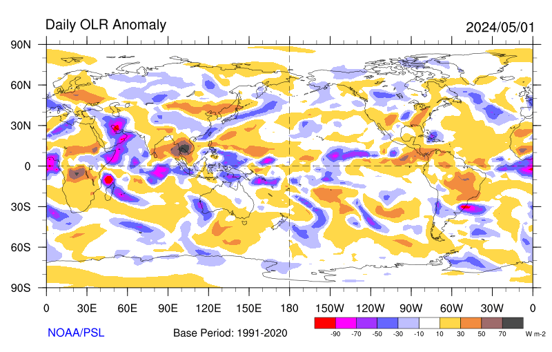
At this time the signal from the MJO is weak with the upper tropospheric divergent response moving through the WH, centered on the Atlantic Ocean. Satellite imagery (eastern hemisphere, full-disk east Pacific, full-disk west Pacific, full-disk Indian Ocean, full-disk Africa; other images available here) has enhanced convection extending from the east Pacific ITCZ across tropical South America and into especially central Africa. Tropical convection is less organized from the west Pacific toward southeast Asia (with the important exception of Typhoon Chanchu; see here). There are sporadic flare-ups across the warm South Pacific SSTs east of the date line in association with Southern Hemisphere (SH) baroclinic wave activity and associated front. Suppression continues to exist across most of the IO and has been extending eastward into most of Australia (latest 3-day averages of OLR total and anomalies here; latest 7-day average here; additional olr plots here). However, satellite imagery does show tropical convection slowly starting to increase across much of the IO during the last couple of days.
Statistical and numerical models of the MJO (see MJO forecasts, Additional MJO tools and forecasts) generally support the notion of enhanced convection returning to the Indian Ocean from tropical Africa by the start of week 2, with suppression across most of Indonesia. SSTs have also remain slightly above average across portions of the central and southern Indian Ocean (~+ 1-2C), which can be a precursor to a re-emerging MJO into the EH. Finally, SSTs also remain ~ plus 1-2C above normal across the tropical southwest Pacific, as well as the subtropical North and South Pacific and Atlantic Oceans. These basins will also contribute tropical convective forcing at times (plot of weekly global SSTAs here). The following are additional MJO monitoring tools:
http://www.cdc.noaa.gov/map/clim/olr_modes/
http://www.bom.gov.au/bmrc/clfor/cfstaff/matw/maproom/RMM/index.htm
http://www.cpc.ncep.noaa.gov/products/precip/CWlink/MJO/mjo.shtml
Monitoring suggests the WH will come back around into the IO from Africa in about a week, and contribute to possibly intense forcing in that region. Tropical convection may also become quite enhanced across the west Pacific during the next 1-2 weeks, with a possible consolidation ~ 120-140E during week 3. The seasonal cycle will play a role to whatever evolutionary route the tropical convective forcing takes during the next few weeks.
Since April 28th the interplay between SSTs, tropical convective forcing and circulation response-feedbacks has transitioned to a current situation best described by GSDM Stage 3. There has been an increase of zonal mean westerly flow throughout the tropical and subtropical atmospheres with anomalies ~5-10 m/s. While much of the downward and poleward propagation of these westerlies has been into the SH, some of this anomalous flow has gone through Africa into central Asia. Working with processes in the northern extratropics such as baroclinic wave packets interacting with north-south mountain ranges, these anomalous westerlies lead to an extension of the EAJ/North Pacific Jet last week. As blocking retrograded from Europe into the North Atlantic/eastern Canada (which would be expected during GSDM Stage 3), synoptic-scale storm development occurred across the central part of the country. That has led us to the blocked/split flow pattern we are currently at.
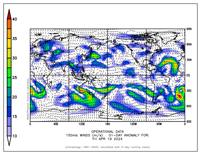
Plots of recent daily mean 150mb and 250mb vector wind anomalies clearly present a signal of twin subtropical anticylones ~40- 60W as well as the lingering pair along the date line. Subtropical cyclones are present across the IO with upper tropospheric wind anomalies ~20-30 m/s south of the equator. The North Pacific Jet remains strong for this time of year, with anomalies ~30-40 m/s. However, there has already been retraction during the last few days.
AAM anomalies were ~.5 standard deviations above the 1968-1997 climatology around May 6, and as of May 10 AAM had returned to about normal. The more up to date plot of AAM based on the operational data which uses a 1979-1998 climatology has AAM ~ 1 standard deviation below normal (see http://www.cdc.noaa.gov/map/images/aam/glaam.gif) Anomalous zonal mean westerly flow was present particularly across the SH tropical and subtropical atmospheres (seasonal cycle), and the midlatitudes (~40-60 away from the equator) of both hemispheres. Anomalous zonal mean easterly flow exists along ~30N and 30S, as well as the NH polar latitudes. The latter are actually a residual of the bursting anticylones that started in March 2006 (discussed in previous postings). Interestingly enough, there was also a weak signal of flux convergence of AAM transport into the NH midlatitudes, which may also be a residual characteristic of the recent La-Nina. Any recent signal of AAM transports was equatorward in both hemispheres as of May 10.
AAM tendency is currently negative (~ 1 standard deviation; see plot), with the frictional torque a contributor (see plot). Global mountain remains positive; however, the east Asia component is negative (Andres torque strongly positive; see plot). In the context of the GSDM, given these observations, after another week of Stage 3, Stage 4 would be most probable by the start of week 2 (next weekend), with a transition to GSDM Stage 1 during the week 3-4 time scale. Of course, timing is always unclear after roughly day 3 and predictive information statements must be expressed probabilistically to maximize skill.
For the PNA sector particularly focusing in the CONUS, the ~140-150W trough -120W ridge and eastern USA trough for the next 5 days is a good bet. Nearly all models and their ensembles have locked onto this prediction which is consistent with GSDM Stage 3 (considering the seasonal cycle). We also have to keep in mind that the current high latitude retrogression of anticyclonic circulation wind anomalies extending from the North Atlantic Ocean (leading to a negative NAO) into eastern Canada (the high-latitude AAM sink as seen from the AAM plots) will be a contributor to the weather across the CONUS not only for week 1, but afterwards.
During week 2, I would think that as the North Pacific Jet retracts and interacts with the retrograding anticyclone, a ridge across the central Pacific possibly extending well into the Arctic may be probable as week 3 approaches. That would suggest a trough to begin evolving just off the USA west coast, linking with a STJ extending into the southwest and south central states. A ridge would then probable across the central USA while a trough lingers across the east and northeast states. During the week 3-4 time-scale, an active GSDM Stage 1 pattern for particularly the northern Rockies and Plains may return (farther north than March due to seasonal transition). Most models now generally agree with this notion at least going into week 2. Experience tells us that the numerical models will likely struggle again as the tropical convective forcing comes back into the EH, particularly should a GSDM Stage 4-1 transition occur. The following is a breakdown for weeks 1-3. My confidence remains low, particularly since I have been struggling with predictions during the last few weeks.
Week 1 (14-20 May 2006): Overall, not a very active pattern for much of the USA. Roughly the eastern two-thirds of the country look to have below normal temperatures with record maximum temperatures probable for locations such as the Interior West through about the middle of this period. Starting ~ the 17th-18th very warm air should spread rapidly eastward into at least the Central and Southern Plains, with maximum temperatures in excess of 100F possible at across TX and OK. Most shower and thunderstorm activity will be east of the Mississippi River, with little precipitation to the west. Even though moisture transport from the Gulf of Mexico will be minimal, the possibility of one or two episodes of strong northwest flow thunderstorms for the Northern Plains/Upper Mississippi Valley cannot be dismissed. Finally, record low minimums and late season frost will be a concern from the northern Rockies into at least the Great Lakes States, at least early next week.
Please see the CPC Drought Monitor for areas of dryness and the latest official outlooks and statements from Storm Prediction Center not only for severe storms, but also fire weather concerns. Finally, the CPC USA Hazards Assessment for offers additional insights not only for possible week 1 high impact weather, but week 2 as well.
Week 2 (21-27 May 2006): GSDM Stage 4 would be probable by the start of this period. Rainfall chances should increase above climatology along the west coast and from the Northern Rockies into Northern Plains/Upper Mississippi Valley. The latter region may include severe local storms as Gulf of Mexico moisture transport improves (SSTs are above average there, ~ plus .5-1C). Warmth should also spread eastward across most of country, with cooler temperatures returning to the Pacific Northwest. Portions of the Southern Plains may see record highs with temperatures in excess of 100F. Lingering cool conditions are possible across the east and particularly for the Northeast.
Week 3 (28 May-3 June 2006): We would think a transition from GSDM Stage 4-1 is a concern for this period and the impacts may continue into the following week. That would mean an active southwest flow storm track pattern for the Plains as troughs come into the western states and then move northeast into the Upper Mississippi Valley. Tropical moisture transport from the Gulf of Mexico should be quite robust by this time. The weather would be similar to what was observed during March, only farther north and west. That could focus a severe local storm hazard from the Northern/Central Plains into the western Great Lakes States.
Specifically for southwest Kansas, I am afraid the dry pattern (for “whatever the reasons”) is generally back. After a cool start early this upcoming week, much warmer temperatures seem likely starting ~ May 17, with highs into the 90s. Starting next weekend into the following week, there may be a strong STJ to contribute to at least high based thunderstorms across the elevated terrain to our west. As these storms move by, lightning and high wind may be more probable than decent rainfall; however, we will see. The main storm track will be shifted north of us, as climatology alone says. Temperatures are likely to remain above average, with days in the 90s (perhaps even a few above 100F in some places). By week 3, should GSDM Stage 1 return, that would suggest troughs coming into the Rockies and then moving northeast into the Upper Mississippi Valley. Severe local storms would likely accompany these. However, with the storm track to our north, that could mean “hot, windy and dry” at times. However, with less momentum to mix down I would think at least dryline storms and attendant rainfall would be possible.
Latest CDC Ensemble Forecast
Latest NCEP Ensemble Forecast
Additional NCEP Ensemble output
Latest Canadian Ensemble Output
Latest CDC Week 2 Forecasts from the CDC Ensemble
Latest Deterministic ECMWF Forecasts
I will try to do an update on about the middle of next week.
Ed Berry
Saturday, May 13, 2006
Wednesday, May 10, 2006
Update
Since I am working on our next weather-climate discussion for the ESRL/PSD MJO web site (link below), I will not have time to post a complete writing on this blog until hopefully sometime this weekend.
http://www.cdc.noaa.gov/MJO/Forecasts/climate_discussions.html
A very well defined convectively coupled signal, weakly projecting onto a MJO, is currently moving across the WH. The phase speed is ~8-10 m/s, and is roughly over the tropical Atlantic Ocean (where SSTs are ~1-2C above normal). Enhanced convection with this feature extends from the east Pacific ITCZ to central Africa. Twin upper tropospheric subtropical anticyclonic circulation anomalies linked to this forcing are present ~60W. Tied to the lingering effects of La-Nina, weakly coherent tropical convective forcing remains centered ~0/150E. Typhoon Chanchu has spun off from this convection. See:
http://www.npmoc.navy.mil/jtwc.html
Convection across the IO remains strongly suppressed. However, I do feel fairly confident the WH will come back around into the EH within the next 10 days. SSTs are ~1C above normal across the IO, and it is probable that the tropical convection will increase rapidly in this region with in the next 1-2 weeks. Another consolidation ~120E is possible roughly late week 2 into week 3 (keeping in mind the seasonal cycle).
GSDM Stage 3 best describes the current weather-climate situation. The current split-flow/large amplitude pattern across North America is going to persist ~5-7 days longer than I thought last weekend. This is partly due to feedbacks from the current high-latitude retrogression of the block that started in northern Europe about a couple of weeks ago. From next weekend into week 2, GSDM Stage 4 would be probable, meaning a continued retrogression the large amplitude ridge particularly from western Canada into the central Pacific. Like the CDC and Canadian ensembles hint at, that would allow the eastern Pacific trough to reach the Pacific Northwest coast during week 2 (with a STJ into the southwest USA). A more spring-like pattern may then return to the CONUS. In summary, what I advertised last weekend for a prediction looks to be delayed perhaps a week. Oh well, I guess I am struggling.
Ed Berry
Saturday, May 06, 2006
What Goes Around Comes Around
Global SSTs remain little changed since my posting on May 3. Across the equatorial cold tongue anomalies are ~.5C with actual SSTs varying from ~26C at 120W to 29C and warmer around the date line. In general 29C and warmer SSTs extend from the South Pacific back into the IO with pockets across the east Pacific and from the Gulf of Mexico into the tropical Atlantic Ocean. The horshoe pattern of anomalous SST warmth prevails across much of the Pacific Ocean basin, especially for the southern hemisphere. This situation projects more on a La Nina than El-Nino. The future of ENSO remains unclear, especially since we are at the so called “spring barrier of predictability”. A contribution to this so-called predictability barrier comes from the seasonal cycle. Please see the following links.
http://www.pmel.noaa.gov/tao/jsdisplay/http://www.cdc.noaa.gov/map/images/sst/sst.anom.gif
http://www.cdc.noaa.gov/map/images/sst/sst.gif
http://www.cdc.noaa.gov/people/klaus.wolter/MEI/
http://www.cpc.ncep.noaa.gov/products/analysis_monitoring/enso_advisory/index.html
The discussion on the MEI was updated on May 5, and I would expect the CPC advisory to be updated within the next week.
The MJO signal (again) remains very weak. However, there have been five ~30-day relatively coherent variations of the tropical convective forcing since December 2005. These have included eastward shifts (with MJO components) from the IO across all of Indonesia, generally along the equator, before stalling. Fast convective signals then generally did propagate into the WH during these events (in concert with other complex variations of the tropical convective forcing), usually in the form of a convectively coupled Kelvin waves (Kws).
Event number five came out roughly 10-14 days ago, then stalled ~5N/150E (it may be starting to move west), while Kws (VERY loosely speaking) propagated into the WH. These Kws have excited tropical convection along both the east Pacific (with the warmer SSTs) and Atlantic ITCZs, the SPCZ, northern South America and central Africa. Some tools to monitor these tropical convective variations can be found from the following.
http://www.cdc.noaa.gov/map/clim/olr_modes/hovEa.html
http://www.ssec.wisc.edu/data/geo/mtsat/
http://www.cpc.ncep.noaa.gov/products/precip/CWlink/ir_anim_monthly.shtml
http://trmm.gsfc.nasa.gov/trmm_rain/Events/big_global_accumlation.gif
http://www.bom.gov.au/bmrc/clfor/cfstaff/matw/maproom/index.htm
The combination of the eastward shift of the EH tropical forcing and the WH signal has added a lot of westerly flow to the tropical and subtropical atmospheres during the last 2 weeks. For instance, upper tropospheric zonal mean westerly anomalies are currently ~5-10 m/s from roughly plus/minus 30 degrees of latitude of the equator.
On roughly April 24th the tendency of global relative AAM was a positive maximum of about 20 Hadleys, which signaled a transition of the global circulation to GSDM Stage 2. An observation I should have taken greater notice to is the relatively strong positive pressure torques due the Andes Mountains which may be linked to above Kws, only helping to add more westerly flow to the atmosphere. One positive Andes mountain torque occurred around April 19th and with another one currently in progress (seasonal cycle favors ~20-30 day regularity to these variations). Thus we are again seeing another positive maximum to the AAM tendency which may lead to a longer period of GSDM Stage 2-3 than I thought last week. The following are links to a few reanalysis AAM plots.
http://www.cdc.noaa.gov/map/images/reanalysis/aam_total/glaam.sig1-21.90day.gif
http://www.cdc.noaa.gov/map/images/reanalysis/aam_total/gltend.sig.90day.gif
http://www.cdc.noaa.gov/map/images/reanalysis/aam_total/gltaum.90day.gif
Cutting to the quick of all this, I do think the WH convective signal will come back around into the EH by the end of week 2 (see May 3rd posting). By that time the Andes mountain torque event should have gone though its life cycle. In addition, we cannot ever forget the East Asian topography. There already are lowering mean sea level pressures across East Asia, which may be helping to offset some of the anomalous zonal mean westerly flow present. Convection is also starting to increase across the IO, and the area from the IO into Indonesia may see intense tropical rainfall by the end of week 2.
The global circulation should mature to GSDM Stage 3 during week 1 (through next weekend), which will include retrogression of the anticyclonic circulation wind anomalies currently across northern Europe/Scandinavia. Given there are still feedbacks present from the lingering La-Nina base state, my thoughts would be for a transition to GSDM Stage 4 by the end of week 2. A signal of that would be a negative minimum of global relative AAM. During weeks 3-4 a transition to GSDM Stage 1 would be probable. After my poor assessment 4 days ago, my confidence in this evolution is low, mainly after week 1.
I think the models (please see past postings for links) look reasonable through at least the middle of next week for the CONUS. Typical of GSDM Stage 2, a trough will dig into the Rockies and Plains (with ridges off the west coast and across the Gulf of Mexico), while blocking retrogrades into Canada. The latter will enhance the split flow across North America, leading to a southward displaced storm track across the Rockies and Plains.
By next weekend into the following week, this pattern should de-amplify with the westerlies shifting north. In the presence of a STJ across the southern part of the country, by the end of week 2 into week 3, troughs may start digging along the west coast with ridging across the south central into eastern states. The blocking across Canada may shift into Alaska.
A cool and wet pattern looks like a good bet for much of the USA well into next week. Most robust cool anomalies are likely across the North and Central Plains into the Great Lakes States. Late season frosts and/or freezes may occur. Heaviest precipitation should focus from the Southern Plains into the Ohio Valley, including severe local storms. During week 2, much of the country will likely warm and dry out, perhaps very quickly. Cool and wet weather may shift back to the Pacific Northwest and perhaps linger across the Northeast. Above average heat may return to the Southern Plains by the end of this period. During week 3, perhaps finally that GSDM Stage 1 pattern for the CONUS will return. After all, I should get it right sometime!
For southwest Kansas, with our GSDM Stage 2-3 split flow pattern (with STJs), I am going to be cautiously optimistic about our rain chances well into next week. All things considered, a situation like this in July could lead to night after night of intense MCSs. Our best opportunity for rainfall should be ~Tuesday-Thursday. Temperatures look to stay below normal for about another week. Indeed, late next week at least frost could be a concern. Starting next weekend into the following week, I think temperatures will warm very quickly and rain chances will decrease. However, the STJ may still help with the rainfall opportunities.
I will try to do an update the middle of next week.
Ed Berry
Wednesday, May 03, 2006
Where Will the Westerly Anomalies Go?
Tropical Pacific SSTs have changed little since my last posting on April 29th. Anomalies along the equatorial cold tongue are generally within .5C of normal with weak cool conditions across the east Pacific and warmth across the date line region. Actual temperatures vary from ~26C near 120W to at least 29C southwest of the date line. The 29C and warmer SSTs (useful threshold for maintaining deep moist convection) generally extend from the IO into the South Pacific and have also recently appeared just south of Mexico (along the ITCZ). At depth there is some warmth of ~plus 0.5-1.5C down to about 200m around the date line, which suggests a slightly deeper than normal ocean thermocline. The horseshoe pattern of anomalous warmth still prevails across the subtropics and lower midlatitudes of the Pacific Ocean, as well as across much of the northern tropical Atlantic. Details can be found from the following links.
http://www.pmel.noaa.gov/tao/jsdisplay/
http://www.cdc.noaa.gov/map/clim/sst.shtml
http://www.nhc.noaa.gov/aboutsst.shtml
The ENSO situation remains unclear. However, there are monitoring tools which suggest the effects of La-Nina are still lingering. The following discussions should be updated within the next week or so to provide additional information.
http://www.cdc.noaa.gov/people/klaus.wolter/MEI/
http://www.cpc.ncep.noaa.gov/products/analysis_monitoring/enso_advisory/index.html
Any MJO signal is still very weak. During roughly the last 10 days an eastward shift of the tropical convective forcing occurred (see April 29th posting), linked to a convectively coupled Kelvin wave (Kw). At this time the centroid of the tropical forcing is at about 5N/150E, and extended from central Indonesia into the west Pacific. Monitoring suggests this enhanced region of tropical rainfall has stalled. Additionally, enhanced rainfall was increasing across both northern South America and central Africa, with strong flare-ups across both the South Pacific (interacting with fronts) and even the eastern Pacific ITCZ.
The point is while the most significant tropical forcing still remains in the EH, there is a signal currently propagating through the WH tied to the Kw. My feeling is that the strongest forcing will remain across the EH, while the propagating signal comes back around into the regions of Africa and the IO during the next 2 weeks. I would expect to see perhaps a rapid enhancement of the IO convection within the next week or so, with possibly the Indonesian rainfall shifting back to the west. Similar to at least 5 previous events going back to December 2005, another consolidation of the tropical convection may occur late week 2 or 3. Please see the following links for details (as well as additional navigation to relevant links).
http://www.cdc.noaa.gov/map/clim/olr_modes/
http://www.bom.gov.au/bmrc/clfor/cfstaff/matw/maproom/index.htm
http://www.ssec.wisc.edu/data/geo/mtsat/
http://trmm.gsfc.nasa.gov/
http://www.cpc.ncep.noaa.gov/products/precip/CWlink/ir_anim_monthly.shtml
GSDM Stage 3 best describes the circulation response to the tropical convective forcing (in addition to other processes). Global relative AAM is still about a half a standard deviation below the 1968-1997 reanalysis data climatology. However, this is an increase from about minus 2 standard deviations from 2 weeks ago (see links below), and I think we are seeing GSDM Stage 3 in the presence of a weak La-Nina base state. Importantly, deep zonal mean anomalous westerly flow of at least 5m/s extends throughout the equatorial and subtropical atmospheres, and downward and poleward movement of these anomalies would be probable. An important question for prediction is just how much are these enhanced zonal mean westerlies going to impact character of the global circulation? Related questions also concern the impact of the both the tropical convective as well as topographic forcing interacting with RWDs within the enhanced westerly flow. These RWDs will be crucial for the synoptic evolution of midlatitude troughs and ridges.
http://www.cdc.noaa.gov/map/images/reanalysis/aam_total/glaam.sig1-21.90day.gif
http://www.cdc.noaa.gov/map/clim/aam.rean.shtml
http://www.cdc.noaa.gov/map/clim/aam.shtml
My own feeling is to continue the thoughts offered on the April 29th writing. The enhanced mid/upper tropospheric westerlies are coming back around through north Africa and are headed toward subtropical Asia. Interacting with the Indonesian tropical convection, an extension of the polar jetstream (East Asian Jet (EAJ)) across the North Pacific ~40-50N is probable. This will be displaced a bit north of what is expected during these kind of situations due to the weak La-Nina base state. Meanwhile, a blocking anticyclone located in the Eurasian sector is probable to retrograde into Canada by the end of week 2. There is a tendency to see retrogression of existing high latitude anticyclonic circulation anomalies from Eurasia into North America during GSDM Stage 3 situations (complicated feedback issues). Starting sometime next week a well defined split flow pattern across North America looks plausible.
Focusing on the CONUS, where will be the most probable location of cyclonic circulation anomalies as the blocking anticyclone retrogrades through Canada? There have been differences in the numerical models (including large ensemble spreads) on resolving this matter. With the tropical forcing remaining well in the EH, I would expect to see closed lows developing across the Rockies and then lifting northeast into the Upper Mississippi Valley. More generally, much of the country may have a southward displaced storm track (regionally due to the Canada blocking; not to be confused with a northward displaced storm track in the zonal mean). With this pattern locations from the Pacific Northwest into the Rockies and Plains may experience the most active weather, including severe storms across the central part of the country. In terms of above average rainfall locations from the Upper Mississippi Valley all the way to possibly even the Mid-Atlantic States may be in line. Portions of the Southern High Plains look to remain dryer than normal.
I think this “GSDM La-Nina springtime version of Stage 3” will mature during week 2, possibly quickly transitioning to GSDM Stage 1 by the end of week 3 (~May 24th). At least for weeks 1 and 2, I do like the solutions offered by the CDC ensemble and ECMWF deterministic run (see links). However, all numerical models are generally starting to converge.
http://www.cdc.noaa.gov/map/images/ens_jsw/ens_jsw.html
http://www.cdc.noaa.gov/people/jeffrey.s.whitaker/refcst/week2/
http://www.ecmwf.int/
For Southwest Kansas, I wish I could offer more optimism for the decent periods of widespread rainfall that most would like to see. I hope that respectable rainfall occurs between now and this weekend. Opportunities for some showers and storms (perhaps linked to the dryline) should exist during the next couple of weeks, particularly with enhanced episodes of the STJ linked to flare-ups across both the South Pacific and eastern Pacific ITCZ. However, above average westerly flow coming across the Rockies starting next week is not at all favorable for repeated widespread rainfall events across southwest Kansas. In addition, should we start to see individual synoptic lows lift northeast toward locations such as Iowa from the Rockies, a couple of days of “hot southwest winds and some blowing dust” is not out of the question. If I were doing a week 2 prediction, it would read “above normal temperatures and below normal precipitation”. Should the circulation transition back to GSDM Stage 1 after this period, that may shift the storm track farther north (which may also not be good for decent rainfall).
For those interested on learning more about our GSDM, the Weickmann and Berry (2006) paper, “A synoptic-dynamic model of subseasonal atmospheric variability”, has just been formally accepted for publication into Monthly Weather Review (MWR). I will try to provide a link to a soft copy of our paper in a future posting on this web site.
I will try to do an update this weekend. We are working on another weather-climate discussion for the PSD MJO web page, which we hope to post within the next week or so (http://www.cdc.noaa.gov/MJO/Forecasts/climate_discussions.html ).
Ed Berry
Saturday, April 29, 2006
Atmospheric Gas and Model Sensitivity
Global SSTs have changed little since my last posting on April 26th. Weakly cool SST anomalies on the order of minus .5C were observed across the eastern equatorial Pacific in contrast to the plus .5C west and southwest of the date line. Subsurface anomalies of plus 1-2C extended to ~250m deep just west of the date line, with perhaps a slight deepening of the oceanic thermocline basin wide. The horseshoe pattern of anomalous warmth continued across the subtropical Pacific, while anomalous warmth prevailed across much of the tropical Atlantic. The status of ENSO (including the recent La-Nina) is indeterminate. The following links provide additional information.
http://www.pmel.noaa.gov/tao/jsdisplay/
http://www.cdc.noaa.gov/map/images/sst/sst.anom.gif
http://www.cdc.noaa.gov/people/klaus.wolter/MEI/
http://www.cpc.ncep.noaa.gov/products/analysis_monitoring/enso_advisory/index.html
After consolidating ~0/120E about 10 days ago, during the past 3-5 days there has been a fairly abrupt eastward shift of the centroid of the EH tropical convective forcing from 120-140E. A convectively coupled Kelvin wave (KW), currently moving into the WH, apparently contributed to this recent behavior. A Hovmoller plot employing time filtering to isolate coherent modes of tropical convective variability illustrates the shift (link below).
http://www.cdc.noaa.gov/map/clim/olr_modes/hovEa.html
An important response to the eastward movement of the tropical convection has been a rapid increase of the zonal mean westerlies throughout the tropical and subtropical atmospheres (particularly northern), with zonal mean anomalies of at least plus 5-10 m/s. The most recent daily mean plot (29 April) of 150mb vector wind anomalies shows equatorial westerly wind anomalies in excess of 30 m/s moving across northern South America. These upper tropospheric westerlies are starting to come back around into Africa and they will impact the IO within the next few days.
http://www.cdc.noaa.gov/map/images/fnl/150wnd_01a.fnl.gif
http://www.cdc.noaa.gov/map/clim/glbcir.anim.shtml
The recent increase of zonal mean anomalous westerly flow across the tropical and subtropical atmospheres has contributed to significant positive tendency of global relative AAM (~20 Hadleys). Specifically, perhaps starting with the positive east Asian mountain torque event nearly 2 weeks ago, the complex interplay between the tropical convective behaviors and baroclinic wave energy packets (subtropical and higher latitudes) have added more westerly flow to the global circulation. These interactions have created serious sensitivity issues with all of the operational numerical models (see previous posting for model performance links) leading to, for example, above average spreads in ensemble members (understanding the role of seasonal transition). The Rossby wave energy dispersion (RWD) which contributed to the large baroclinic cyclone on the Plains at the time of this writing has been part of all these complex processes. I do believe this RWD is having a role with the current acceleration of the westerly flow (a “positive AAM tendency RWD”). In our GSDM (Global Synoptic Dynamic Model of subseasonal variability; also have used “SDM” in past postings) we try to capture these kind of multiple time and space scale interactions.
The point is I think the atmosphere is quickly transitioning to GSDM Stage 2, and I would not have expected that even a few days ago. Actual global AAM has increased roughly 1 standard deviation during the last 5-7 days, although still remains below average. There is still zonal mean anomalous easterly flow throughout a good portion of the midlatitude atmospheres of both hemispheres, a “lingering effect” of La Nina. The links below are to various plots of the AAM budget, if interested (the reanalysis plots are updated).
http://www.cdc.noaa.gov/map/images/reanalysis/aam_total/gltend.sig.90day.gif
http://www.cdc.noaa.gov/map/images/aam/glaam.gif
http://www.cdc.noaa.gov/map/images/reanalysis/aam_total/glaam.sig1-21.90day.gif
http://www.cdc.noaa.gov/map/clim/aam.rean.shtml
Where does the global circulation go from here? I do think it is plausible for convective flare-ups to occur across the east Pacific ITCZ due to warmer SSTs as the above mentioned KW moves through the WH. However, given the larger area of 29C and greater SSTs across the South Pacific, I would think it is more probable for the SPCZ to see convective enhancement during the next week or so (again, there is the seasonal cycle, which may work against that). The point is we may see a weak GSDM Stage 3 response by week 2, only to quickly collapse and revert back to the GSDM Stages 4-1 by roughly weeks 3 and 4. This scenario is quite different from what I was thinking during my last posting, and obviously my confidence is all of this is very low. However, the CDC reforecast ensemble does offer some support to this notion. Given the persistence of anomalous zonal mean easterly flow across the mid-latitudes, any extension of the east Asia/North Pacific jet would be expected to be a bit north of climatology (stated loosely to reflect uncertainty).
http://www.cdc.noaa.gov/map/images/ens_jsw/ens_jsw.html
Focusing on the PNA sector and specifically for the CONUS, GSDM Stage 2 appears most probable at least into next weekend. That would suggest a ridge building just off the USA west coast, and a trough initially digging into the Rockies before moving into the Plains (need to keep in mind the shorter wavelengths given spring). Impacts would include at least intrusions of relatively cool air initially into the northern Rockies, before spreading across the Plains and eventually to the eastern states. Most significant precipitation would be expected from the south central states possibly into the mid Atlantic region. The western states into the northern High Plains may stay dry. By week 2 (~5/7-14) the westerlies should impact the west coast, with a split flow pattern again across much of North America. I would think more strong troughs with closed lows may move through the central and southern Rockies before turning northeast. This may lead to an active storm track from the southern Rockies into at least the central and northern Mississippi Valley, including more severe local storms (with a “blocking like” ridge across central and eastern Canada). By weeks 3-4, perhaps that northwest shifted pattern of what we observed during much of March will materialize. Again, useful predictive information needs to be expressed probabilistically at these time scales for skill and accountability to be realized.
For southwest Kansas, whatever scenario the global circulation takes, it still does not look too promising for the real repeated events of beneficial rainfall everyone would like to see for at least the next 2-4 weeks. There will be a couple of opportunities for showers and storms this upcoming week ~ Wednesday-Friday. For the following week it all depends on how far south the storm track is. The above mentioned split flow pattern would be favorable for us, especially if we have a decent STJ to go with it. However, let’s just see what happens. Understanding temperature variations, the above normal tercile looks like a good bet for bi-weekly to monthly mean temperatures well into May.
I will be on travel next week. Thus it may not be until next weekend before I post another update.
Ed Berry
Wednesday, April 26, 2006
What a Mess!
SSTAs across the equatorial central and east Pacific are close to normal with values varying from ~minus .5C around 120W to ~plus .5-1C across the southwest region of the equatorial date line. Somewhat cooler values were just off the coast of South America while plus 1-2C anomalies persisted across the subtropical South Pacific. Warm anomalies have recently emerged across the central Pacific near 30N. While La-Nina in regard to SSTAs across the equatorial cold tongue have “disappeared”, the general spatial distribution of warmth throughout the north and particularly the south subtropics of the Pacific are still consistent with a cold event. The latter is an important point I should have made clear in previous postings. The ramifications to the future of ENSO are unclear to me. Actual SSTs of 29C and greater continue from the IO into the South Pacific, as well as portions of the tropical Atlantic basin. The following are links to SST information and on the status of ENSO. I would expect the ENSO discussions to be updated within the next 2 weeks or so.
http://www.pmel.noaa.gov/tao/jsdisplay/
http://www.cdc.noaa.gov/map/images/sst/sst.anom.gif
http://www.cdc.noaa.gov/map/images/sst/sst.gif
http://www.cdc.noaa.gov/people/klaus.wolter/MEI/
http://www.cpc.ncep.noaa.gov/products/analysis_monitoring/enso_advisory/index.html
The EH tropical convective forcing continues to consolidate and maintain intensity with a centroid around 0/120E. The envelope of this enhanced tropical precipitation extended from the central IO across Indonesia into the extreme western Pacific. Two active regions within this envelope were northeast of Australia and the Bay of Bengal. At this time Tropical Cyclone (tropical storm intensity) Mala was occurring across the southern Bay of Bengal while a disturbed area of weather persisted northwest of Australia. Weekly mean OLRAs were on the order of ~minus 50-90 W/m**2 throughout this convective envelope. Perhaps linked to a weak convectively coupled Kelvin wave, at least an enhanced diurnal cycle of intense thunderstorm clusters has been occurring through most of northern South America as well as central Africa during the last few days (see links below).
http://www.ssec.wisc.edu/data/geo/mtsat/
http://www.cdc.noaa.gov/map/images/olr/olr.alt.anom.gif
http://www.npmoc.navy.mil/jtwc.html
http://www.cdc.noaa.gov/map/clim/olr_modes/hovEa.html
http://www.cdc.noaa.gov/map/clim/olr_modes/
http://www.cdc.noaa.gov/map/clim/olr.shtml
http://www.cpc.ncep.noaa.gov/products/precip/CWlink/ir_anim_monthly.shtml
My thought for about the last week has been for the EH tropical forcing to consolidate and then move east possibly projecting onto a MJO. However, Hovmoller plots of fields such as tropical surface wind anomalies (within 15 degrees of the equator) present a pattern of enhanced trades to the east of 120E and a WWE across the central IO that has persisted for at least the past 10 days. That same persistence was observed from Hovmoller plots of OLR/OLRA, including the time-filtered coherent modes (see links above). At this point I think it is a monitoring issue to see if the atmosphere wants to stay in a general persistent “La-Nina like regime” or shift to “something else”.
I think SDM Stage 1 currently best describes the global circulation; however, any objective signal of that pattern is not clean. Subtropical wave trains and STJs still continue across both hemispheres (a characteristic of Stage 4). Perhaps the most distinctive change in the global circulation during the past 7-10 days has been the increase of zonal mean upper tropospheric westerly flow throughout the tropical and subtropical atmospheres, with anomalies ~5 m/s. Accompanying this change has been an eastward shift of the upper tropospheric subtropical anticyclones to ~120E (where the convection is centered at) and development of downstream cyclones just east of the date line. This observation suggests to me the circulation has loosely transitioned back to SDM Stage 1, from SDM Stage 4 of about week ago (see AAM tendency link below – first one).
Anomalous zonal mean westerly flow also continues ~45-60N and S, with magnitudes ~10-15m/s. Elsewhere, zonal mean easterly anomalous flow dominates. Global relative AAM is still close to 3 standard deviations below the 1979-1998 climatology, but having gone up a bit during the last week or so. The point is that once again there is increasing meridional symmetry of zonal mean zonal wind anomalies which is similar to what was seen from ~mid February to early this month. That is a classic footprint onto the atmosphere of tropical convective forcing becoming dominate (keeping in mind the importance of the seasonal cycle).
http://www.cdc.noaa.gov/map/images/reanalysis/aam_total/gltend.sig.90day.gif
http://www.cdc.noaa.gov/map/clim/aam.rean.shtml
http://www.cdc.noaa.gov/map/images/aam/glaam.gif
So, the atmosphere may like the La-Nina base state that it has occupied since last fall. During my past writings I have at least implied that this cold event may be over, not only for the SSTs, but also for the atmospheric response as well (understanding lag relationships, the seasonal cycle (again), etc.). Have I been premature?
Of course there are other contributions to the characteristics of the circulation such as major north-south mountain barriers. As stated before, anomalous high pressure across the east Asian topography has recently exerted a positive torque onto the atmosphere, likely contributing to the current split flow pattern across North America.
Focusing on the PNA sector, strong anomalous westerly flow continues throughout the subtropical north Pacific contributing to the STJ now impacting the southwestern part of the country. Meanwhile, directly linked to the EH tropical convective forcing interacting with baroclinic wave packets crossing both north and south Asia (interacting with the topography), a complex Rossby wave energy dispersion (RWD) is currently impacting the CONUS, including the AWB trough just off the CA coast. The interplay of this RWD and the STJ has created serious sensitivity issues with many of the operational numerical models resulting in greater than climatology ensemble spread as early as day 3 (this Saturday). For the USA the issue is whether or not there will be a phasing of the northern and southern branches of the westerlies to lead to storm development on the Plains this weekend. Short answer is I think so, since this is what would be expected during a SDM Stage 1 situation. In addition, this evolution is the start of a process that the atmosphere dynamically has to do to begin the resolve the split flow across North America. Weather impacts would include severe local storms across the Southern Plains and Deep South with heavy rainfall over much of the central states into at least Ohio and Tennessee Valleys as the system moves east.
After the storm event this upcoming weekend, I think that as we go into week 2, it is probable that more troughs will start digging into the western part of the country particularly starting by next weekend (~May 6-7; again, timing is white noise). The SDM Stage 1 circulation should mature, especially once of the lobe of the polar vortex becomes displaced to the north of the 120E tropical convection. The latter will likely be observed as a northern high-latitude retrogression of circulation anomalies. Bottom line is the CONUS may have similar weather during this time as was observed most of March into early this month, except farther northwest. Given the warm SSTs of the South Pacific, a robust STJ may accompany this pattern. Unless the EH tropical forcing shifts east as a MJO (for example), the pattern of synoptic-scale western CONUS troughs lifting northeast into the Plains/Upper Mississippi Valley with a southeast states ridge may persist at least into week 3. I think the readers are quite familiar with the weather impacts of this pattern by now.
As an aside, below are some links to measures of numerical model performance, as well as some of the models (any search will find more). Notice the recent drop in skill about 10 days ago, with the longer-term general decline attributable to seasonal transition into spring. I suspect model performance will again decrease during the next few days.
http://www.cpc.ncep.noaa.gov/schemm/z500ac_wk2_na.html
http://www.cpc.ncep.noaa.gov/schemm/score3.html
http://www.emc.ncep.noaa.gov/gmb/ens/targ/hgtmenu.html
http://www.cdc.noaa.gov/map/images/ens_jsw/ens_jsw.html
http://www.cdc.noaa.gov/map/images/ens/ens.html
For southwest Kansas, perhaps I should have kept some of my optimism I had a week ago for rainfall this coming Friday and/or Saturday. A lot will depend on where “everything comes together”. There may be a sharp gradient from northwest to southeast of very little to “a lot” of rain (and possible severe storms). In any case, still a great deal of uncertainty. There may be another opportunity for rain/storms about the middle of next week with a Pacific cold front. Starting around next weekend into the following week, very warm and dry weather would be most probable. However, a strong STJ along with less southwesterly momentum to mix down (climatology) may mean better opportunities for at least dry line storms.
I will try to do another update this weekend.
Ed Berry
Sunday, April 23, 2006
SDM Stage 4 to 1 Transition -- Update
Please refer to previous postings for web links. I do want to keep this writing relatively short.
In terms of SSTs, La-Nina is ill-defined. Near equatorial central and east Pacific SSTAs are within .5C of normal. At depth anomalies as high as plus 1C exist down to 200m in the region of the date line. Actual tropical SSTs range from ~26C just west of South America (where weakly cool anomalies still exist) to 29C and warmer from just west of the date line back into the IO. Of interest are the very warm SSTs across the tropical and subtropical South Pacific with SSTAs at least plus 1.5C and actual SSTs at least 29C. This region has been supporting intense tropical convective flare-ups over the past several weeks.
The main news about the tropical convective forcing is the maturing consolidation centered around 0/120E, with enhanced tropical rainfall extending from the southeast portions of the Bay of Bengal east-southeast to all of Indonesia and northern Australia. The portion that propagated west during the last week or so contributed (which weakly projected onto a convectively coupled Rossby mode) to the formation of currently Severe Category 5 Tropical Cyclone Monica which is battering northern Australia as I type (see http://www.bom.gov.au/weather/nt/cyclone/ for details).
A WWE across the IO did accompany this consolidation. This and other tools tell me it is probable the tropical forcing should shift east at least into the western Pacific during the next few weeks. This may be our 4th event of ~30-day variations of tropical forcing we have been observing since December 2005. As discussed in my last posting, there have been MJO components to these variations. The impacts of the seasonal cycle on this behavior including circulation impacts adds uncertainty to any kind of subseasonal prediction.
AAM remains ~3 standard deviations below the 1979-1998 climatology. However, during the last few days there has been some increase, with much of it coming from the northern extratropics between 45-60N (which has shifted north during the past couple weeks). Zonal mean westerly flow has also been slowly increasing across the northern subtropics. For me to explain possible sources dynamically for the recent anomalous AAM variations we have been seeing is well beyond what I can write here. Suffice to say the recent increases in the anomalous zonal mean westerly flow across the northern higher midlatitudes may have had some contribution from the east Asian topography. The impact for North America has been the anomalous split flow pattern during roughly the past week.
I think SDM Stage 4 still best describes the global circulation. STJs are present, including the one impacting the southwestern USA. In concert with the positive east Asian mountain torque, the atmosphere transitioned to Stage 4 about 10 days ago. Week-2 numerical model performance was impacted, including the GFS ensemble (see link below). During the next couple of weeks, I think the circulation will transition to a mature SDM Stage 1, taking into account the seasonal cycle. SDM Stage 1 may persist into week 3.
http://www.cpc.ncep.noaa.gov/schemm/z500ac_wk2_na.html
In addition to the possible eastward shift of the tropical forcing, I think the lobe of the polar vortex (in terms of cyclonic circulation wind anomalies) will become displaced toward east Asia (instead of centered on North America at this time), directly north of the tropical convection. That will contribute to a lowering of surface pressures (and lead to negative mean sea-level pressure anomalies) across the east Asian topography (in a probable sense). Punch line is we should see the anomalous zonal mean westerlies come back south and contribute to more full latitude energetic troughs slamming into the western part of the country by the end of week 2 (weekend of May 6-7). Of course, timing is nothing short of very difficult, especially this time of year and in a complicated transitional circulation regime such as this. The only thing anyone can do with defensible skill (and accountability) is offer probabilistic statements rooted in solid science for predictions after about 3-5 days.
For the CONUS, week 1 looks generally anomalously cool and wet for the southern Rockies into the Deep South and eastern portions of the country while the Great Lakes into the Northern and Central Plains and Northern Rockies looks quite dry. Warmest anomalies look to be centered across the Northern Rockies. The Pacific Northwest may trend to cooler and wetter by about a week from now. This kind of temperature and precipitation response would be expected with split flow, going along with a moist STJ. Severe local storm activity should be reduced (considering climatology).
During week 2, the weather looks to get active for the western and eventually the central part of the country. This should be similar to what was observed during March into early April, only a bit farther northwest. Severe local storm activity across the Plains may become very robust by the end of this period (understanding the impossible predictability of details like quality of tropical moisture transport, instability, etc.) while generally cool and unsettled weather returns to much of the western states. The south central and much of the eastern USA may return to above average temperatures. As stated before, there is a climatology component to an active southwest flow storm track across the central CONUS during the first part of May. Perhaps this period will be enhanced, and may persist into week 3.
For southwest Kansas, I hope we get some measurable rainfall today or Monday (4/23,24). I am afraid I have (again) been getting too optimistic about our precipitation chances recently. I am concerned that the next STJ, etc., closed low for later this upcoming week may stay too far south to give us any rainfall as the northern branch starts to come south. That situation will have to be watched.
During week 2, once troughs start digging into the western part of the country and then lift northeast toward Iowa and the Northern Plains/Upper Mississippi Valley, the probability of "devil days" (anomalously warm and dry days with "strong" southwest winds/blowing dust) will go up. However, the seasonal cycle should mitigate some of that meaning at least some possibility of dryline type storms. Also, given the warm SSTs across the tropical South Pacific (discussed above), we may also get some opportunities from a moist STJ ahead of these western states troughs. Understanding variations of temperature (perhaps freezing temperatures Tuesday and Wednesday this week), the above normal tercile looks like a good bet for a mean temperature the next couple of weeks.
I will try to post another update about the middle of next week.
Ed Berry
Wednesday, April 19, 2006
Tropical Convection Regrouping
In terms of the SSTs, La-Nina continues to fade. In the equatorial regions from at least the west central Pacific to the South American coast anomalies are less than 1c with actual temperatures from ~27C near 120W to 29C and higher from the date line on westward into the IO. At depth near equatorial SSTs are tilting to slightly above normal varying from ~plus 1c near 115W/50m to ~ plus 2C around 160E/150m. Very warm SSTs continue throughout much of the subtropical South Pacific with anomalies ~plus 1-2C and actual temperatures at or above 29C (ideal threshold for supporting persistent deep moist convection, for our purposes). Please see links below for details of global SSTs.
http://www.pmel.noaa.gov/tao/jsdisplay/
www.cdc.noaa.gov/map/images/sst/sst.anom.gif
I gave some links in my April 15th posting for information on where ENSO may be going. Tools such as IRI and POAMA suggest a warm event by the end of this year. However, to me there is much uncertainty.The atmospheric circulation still continues to behave in a La-Nina like base state, with, for example, relative AAM more than 3 standard deviations below the 1979-1998 climatology (see link -- reanalysis plots not current). This is about what was observed in mid January and mid March, and possibly the lowest value observed for at least the past year (even with the stratospheric QBO apparently currently switching into the westerly phase). As stated previously, contributing to the vertically and globally averaged reduced atmospheric westerly flow is deep zonal mean anomalous easterly flow throughout the tropical and subtropical atmospheres. There is zonal mean anomalous westerly flow from ~45-60N, which I can attribute to an eastward shift of the tropical convective forcing from Indonesia to the west Pacific during late March and early this month.
http://www.cdc.noaa.gov/map/images/aam/glaam.gif
Whether or not this is telling us there will be a "lag time" between La-Nina going away and a response in the atmospheric circulation (for that time-scale) is unclear. The eastward shift of the tropical convection in late March did contribute to a fairly coherent propagating upper tropospheric divergence signal (as seen from plots of 200mb velocity potential -- link below) into the WH. At this time that signal is re-emerging into the EH, and as seen from full-disk satellite imagery, intense tropical convective flare-ups are in progress across both the IO and north of Australia (more said below). The point is that this recent dip in the AAM and expected responses of other related indicies (including measures of subseasonal variability -- see SOI link below) would be expected given the tropical forcing. This forcing does interact with La-Nina, and in fact, may be currently contributing to its rapid demise working in concert with the seasonal cycle (recall the east Pacific equatorial westerlies discussed in previous posting).
http://www.cpc.ncep.noaa.gov/products/precip/CWlink/ir_anim_monthly.shtml
http://www.bom.gov.au/climate/current/soi2.shtml
As said so many times previously, the current MJO signal is weak. However, retrospectively from reviewing plots such as the time-filtered Hovmollers to isolate coherent modes of tropical convective variability, one could argue there may have been moderate MJO signals back in January and again during March (see link below). These were part of the 30-day variabilities discussed during past postings. Perhaps their time-scales were determined by the SST distributions and other behaviors that we have so much to learn about (ex., non-linear feedbacks from the extratropics).
http://www.cdc.noaa.gov/map/clim/olr_modes/
Satellite imagery (and information which can be derived from it such as tropical rainfall) has been showing observational signals for the tropical convective forcing to consolidate around 0/120E. Flare-ups across the IO and especially north of Australia (latter involving Tropical Cyclone Monica; see http://www.npmoc.navy.mil/jtwc.html) continue.In general, this region of tropical forcing extends from the central IO eastward to just east of Australia, centered on the equator.Upper tropospheric divergence has been increasing from this region, and is currently interacting with a South Asian wave train and subsequent Rossby wave energy dispersion (RWD) across the North Pacific. This RWD is leading to a large upper tropospheric anomalous anticyclonic circulation across the central Pacific which is linked to a progressive but deepening trough off the USA west coast. The combination of the diverent outflow from the convection and a northeast-southwest tilted trough is contributing to an accelerating STJ from west of the date line aimed toward the southwest USA. The bottom line is globally the circulation appears to be starting a process of transitioning from SDM Stage 4 to 1 (low to high zonal wave number transitions across the extratropics), and the sequence of events just described for the PNA sector is consistent with that notion.
http://trmm.gsfc.nasa.gov/trmm_rain/Events/big_global_accumlation.gif
http://www.ssec.wisc.edu/data/geo/west/
http://www.ssec.wisc.edu/data/geo/mtsat/
http://www.cdc.noaa.gov/map/clim/glbcir.anim.shtml
We have observed numerical models struggle performance wise with synoptic events during these types of transitions. However, today I saw the deterministic output from the ECMWF, GFS and Canadian models give signals of linkages of the northern and southern branches of the westerlies by early next week. The result would be for baroclinic cyclone development on the Plains involving the above mentioned moist STJ starting on about next Monday. While the details still need to be resolved, I think that solution is probable. Impacts would include not only severe local storms across particularly the Central and Southern Plains, but also much needed rainfall for drought stricken parts of the country (including the eastern part of the country from the downstream system).
In general, increasingly active weather for much of the country seems probable for week 1. Later this week through this upcoming weekend, disturbances moving along the southern branch of the westerlies (which will include the STJ) should give some welcome rainfall for Southern Rockies into the Southern Plains. Once storm development occurs on the Plains early next week, in addition to the possibility of severe local storms, heavy rainfall may also be a concern for the Mid/Upper Mississippi and Ohio Valleys. Colder air following in the wake of this system is likely to bring below normal temperatures including overnight freezes to at least much of the northern and central part of the country.
For week 2 and going into the first week in May, I would expect the split flow situation across North America to consolidate since the SDM Stage 1 circulation should mature. That would suggest a return to more amplified ridges across the central and east Pacific with energetic troughs entering western North America while ridging returns to the southeast USA. However, given the recent sudden changes in boundary forcing (tropical Pacific SSTs, for example) and the ongoing seasonal transition, my confidence with this notion is low. If the current EH tropical convective forcing evolves into a MJO, then a robust SDM Stage 1 response would be more probable. Impacts from this type of pattern would be similar to what was seen during much of March, but shifted a bit farther north and west. There is a climatology component to an active severe local storm situation across much of the Plains during roughly the first week in May.
For Southwest Kansas, I think we will have some opportunities for rainfall this upcoming weekend into the first part of next week (which may include severe thunderstorms). Our opportunities for rainfall for week 2 will depend on the tracks of the individual synoptic lows (critical whether we get "devil weather" and/or heavy rainfall and severe storms). I think there will continue to be an active STJ,which can be favorable for precipitation. Temperatures may cool to near normal for a week 1 average (including overnight freezing temperatures early next week), with a return to above normal readings for week 2. The latter may again include max temperatures at least well into the 90s.
I will try to post an update this weekend.
Ed Berry
Saturday, April 15, 2006
Low AAM
Tropical Pacific SSTs are relatively ill defined as compared to the past several months of La Nina. Along the equatorial cold tongue anomalies are less than .5C (actual SSTs at least 27-29C east of date line), and at depth anomalies are less than 1C. Interestingly, during the past week or so, linked to dynamic interactions with extratropical wave trains of both hemispheres that were tied to the eastward shift of the Indonesian tropical convection, anomalous surface meridional flow toward the equatorial east Pacific occurred. The anomalous convergence near the equator lead to westerly wind anomalies of at least ~5 m/s, which may have initiated a weak downwelling oceanic Kelvin wave (at least "of sorts") starting near 160W-170W. This process may have been responsible for the sudden weakening of the cool SST anomalies there (considering the seasonal cycle). Links below will lead to additional global SST information as well as animations.
http://www.pmel.noaa.gov/tao/jsdisplay/
http://www.cdc.noaa.gov/map/images/sst/sst.anom.gif
http://www.cdc.noaa.gov/map/clim/glbcir.anim.shtml
The point is there have been significant changes to the SST boundary forcing during the past 2-4 weeks. This has lead to a breakdown of the coupled atmospheric response involving relatively persistent EH tropical convective forcing and SDM Stage 1 circulation (and a rapid loss of numerical model skill recently), which has been observed from about mid February to early this month. The latter has been responsible for several mid-latitude troughs deepening initially across the east Pacific (as well as so-called Kona lows), then slamming the CONUS leading to a very active weather pattern (impacts have already been discussed). In general, the winter of 2005-2006 has been extremely interesting presenting many challenges to the SDM particularly with non-linear feedback issues. Our weather-climate discussion dated February 15th gave some attention to these matters (see link below).
http://www.cdc.noaa.gov/people/klaus.weickmann/disc021506/weather_climate_discussion_10Feb06.html
Perhaps all of the above, working with the seasonal cycle, is one mode of how La-Nina dissipates. Whether this is the case or not, is unclear. The following links give some attention to the state of ENSO.
http://www.cdc.noaa.gov/people/klaus.wolter/MEI/
http://iri.columbia.edu/climate/ENSO/currentinfo/SST_table.html
http://www.cpc.ncep.noaa.gov/products/analysis_monitoring/enso_advisory/index.html
http://www.bom.gov.au/bmrc/ocean/JAFOOS/POAMA/exproducts/poama_v10/fc_rt_nino_l30.htm
We will see what happens.
At this time, from a weather-climate monitoring viewpoint, most signals are very weak, including the MJO. There is some evidence of a coherent eastward moving tropical convective signal across the WH, per link below, about to re-emerge into the EH.
http://www.cpc.ncep.noaa.gov/products/precip/CWlink/ir_anim_monthly.shtml
I do think this notion is reasonable. Full-disk satellite imagery offers support, including some evidence of tropical convection starting to slowly intensify from the IO-Indonesia.
http://www.ssec.wisc.edu/data/geo/mtsat/
Finally, there is a robust relative AAM signal, with current values nearly 3 standard deviations below the 1979-1998 climatology (link below). This value is getting to levels we saw back in both mid January and mid March. Much of this low AAM is coming from increasing deep zonal mean anomalous easterly flow throughout the subtropical and tropical atmospheres. I suspect the tendency of AAM is also negative (reanalysis plots contain data only through April 9th at the time of this writing at
http://www.cdc.noaa.gov/map/clim/aam.rean.shtml ).
http://www.cdc.noaa.gov/map/images/aam/glaam.gif
The punch line is that I do think SDM Stage 4 best describes, loosely, our current weather-climate situation. Complications include what may a positive east Asian mountain torque leading a northward displaced extension of the EA/North Pacific jet toward North America as I type (which will contribute to the next western states trough this upcoming week). I also suspect tropical convective forcing will robustly re-emerge into the EH in the region of the IO-Indonesia during the next 2 weeks, and that the circulation will revert back to SDM Stage 1 by early May. In the meantime, SDM Stage 4 favors STJs (and at least weak southern branch storm tracks) globally, including the southwestern part of the USA.
For the USA and North America, I think we will see a lot of split flow for the next 1-2 weeks. Most operational NWP and their ensembles have been picking up on this for the past few days. For instance, there has been a trend to take the next western USA trough/closed low evolution around Tuesday-Wednesday next week farther south. By week 2 (~April 23-29), I think this split flow will mature with lots of high pressure across Canada and low pressure across the southwest and south central part of the CONUS (vertical structures and dynamics understood). Later during week 2 and week 3, I suspect more ridging may return to the central and east Pacific leading to more energetic western USA troughs (there is a climatology component to this, which may be enhanced in this case).
After relatively active weather for parts of week 1, there should be some respite at least from severe local storms for portions of the northern USA week 2. Meanwhile, many of the dry regions of the Southwest and Southern Plains may get some needed rainfall week 2, which may also spill into the mid/upper Mississippi Valley, for example. Most of the country will probably see warmer than normal temperatures both weeks, although perhaps closer to normal week 2. Locations such as the Northeast and southwest deserts may see below normal temperatures week 2. The first week or so in May may be a delight for storm chasers on the Plains/Upper Mississippi Valley.
For southwest Kansas, there may some chance for a showers and thunderstorms around late Tuesday or early Wednesday. Starting around next weekend through week 2, even after yet another day of "devil weather (southwest winds and blowing dust, very warm temperatures, extreme fire danger, etc.)" I like our rain chances. I am probably being too optimistic, but that is fine. In fact, rainfall may even average above normal for week 2. I hope that it does, because some of that "devil weather" may return starting in May. Even with shots of cool air, temperatures should tilt toward the above normal tercile for the next 2 weeks.
I will try to post an update the middle of next week. Also, we do need to start work on a weather-climate discussion for the ESRL/PSD MJO site, which will take time.
Ed Berry
Wednesday, April 12, 2006
Slopping Around, Seasonal Transition and Discipline
Important weather-climate changes have continued since my April 8th posting. I will have to be brief.
Equatorial cold tongue SSTs have continued warm with the readings no lower ~27C from about 120-140W with overall very weak anomalies. SSTs of 29C and greater continue from the South Pacific (anomalies ~1.5C over the subtropics) into the IO. See the following links for global SST details:
http://www.pmel.noaa.gov/tao/jsdisplay/
http://www.cdc.noaa.gov/map/clim/sst.shtml
The most recent of our ~30 day modes of tropical convective variability reached Indonesia about a week ago, before losing its coherence. Since early January, there have been 3 such situations, with the first and most recent (number 3) having at least weak MJO components. During the past week a reasonably strong convectively coupled Kelvin wave moved into the western hemisphere (WH). Per time-filtered Hovmoller plots of OLRA, the convective signal with this Kelvin wave is currently in the region of northern South America. Other areas of tropical thunderstorm clusters continued across Indonesia, the South Pacific and central Africa. The point is at this time any coherent convective signal is likely in the WH, with the other more regionalized forcing linked to SSTs and even the seaonal cycle.
http://www.cdc.noaa.gov/map/clim/olr_modes/hovEa.html
Global relative AAM remains ~2 standard deviations below the 1979-1998 climatology. However, there was some increase in the anomalous zonal mean westerly flow across the subtropical and tropical atmospheres during the past 2-3 weeks, tied to the most recent eastward shift of the tropical convection. This westerly flow did propagate into the lower mid latitudes, and contributed to the recent increase of the east Asian/North Pacific jet at ~50N. Zonal mean anomalous easterly flow is again returning to much of the tropical/subtropical belt while peristing across the north polar latitudes (see link below). In terms of the SDM, the circulation loosely transitioned from Stage 1 to 2.
http://www.cdc.noaa.gov/map/images/aam/glaam.gif
To summarize thus far, while eastward shifting tropical convective forcing events numbers 1 and 3 had some similarities (see previous posting for details), the circulation response was quite different. Event number 1 lead to SDM Stage 3 whereas number 3 barely got the atmosphere into Stage 2. Reasons for this are tremendously complex, and do include issues such as the La Nina base state, non-linear feedbacks and the seasonal cycle. Additionally, the stationary circulation regime we have seen since mid-late February linked to La-Nina (SDM Stage 1) is breaking down as La-Nina itself is currently weaking (loosely stated). My thought is that we may start to see more oscillatory behaviors, which will require serious disciplined daily weather-climate monitoring. This includes the notion that is not unreasonable to expect enhanced tropical convective forcing to re-emerge into the IO by ~late week 2, and see the circulation (and tropical convection) go into SDM Stage 4 by then (by passing Stage 3).
I like the general idea of most models bringing at least a couple of more troughs into the western and central part of the country for week 1. This will all be in the presence of increasing split flow across North America. During week 2, many models are starting to show a retrogression of the trough position that has been just off the USA west coast for at least the past 6 weeks to around 150W or so. That notion is also not unreasonable. However, given all considerations, as the North Pacific jet starts to retract, a more full-latitude ridge may develop in the region of the western states (with still split flow and perhaps a closed low or two across roughly the Southern Plains). Once tropical convection becomes enhanced across the IO into Indonesia by ~ late week 2 into weeks 3-4, retrogression may continue across the PNA leading to more western USA troughs by early May (back to SDM Stage 1).
Punch line is that after about another week of relatively active weather for much of the country, there should be roughly a week or so period of quiet weather. However, a very active storm track from the Rockies into the Plains may become established by early May, which would also consistent with climatology, but perhaps enhanced. My confidence in this predictive insight is definitely low.
For southwest Kansas, again I have been getting a bit too optimistic about rainfall recently. The weather for at least the next week looks very warm with lots of wind and little precipitation. For week 2, it is possible a southern closed low(s) could bring us some needed precipitation. However, temperatures are likely to stay above normal and the odds would still tilt toward continued dryness.
I will try to do an update this upcoming weekend.
Ed Berry
Saturday, April 08, 2006
Status Quo Days are Over, at Least Globally
Daily monitoring of the tropical Indo-Pacific SSTs suggests to me our cold event is on the wane (seasonal cycle understood). Anomalies throughout the equatorial belt are weak, ~plus/minus 0.5C, with values at around 200m depth still ranging from ~plus 1-2C west of date line with comparable negative values for the east Pacific. Additionally, there has been an eastward shift of the coolest tropical Pacific water for at least the past 2-4 weeks. That translates to 27 and 28C SSTs moving into the WH, while the critical 29C and greater waters have still remained west of date line into the IO as well as the South Pacific. Please see the link below for details.
http://www.pmel.noaa.gov/tao/jsdisplay/
The tropical convective forcing has just completed another ~30 day EH variation with the recent eastward movement from the IO into Indonesia (see previous postings). This is the third event since early January, and at least the first and most recent events have had MJO components to them. The time-filtered OLR/OLRA coherent modes Hovmollers from both ESRL/PSD and BMRC nicely summarize these behaviors (links below).
http://www.cdc.noaa.gov/map/clim/olr_modes/hovEa.html
http://www.cdc.noaa.gov/map/clim/olr_modes/
http://www.bom.gov.au/bmrc/clfor/cfstaff/matw/maproom/OLR_modes/index.htm
During January, event #1 robustly moved into the region of the southwest Pacific, and strongly enhanced thunderstorm activity along the South Pacific Convergence Zone (SPCZ). That added zonal mean westerly flow to the atmosphere, and global relative AAM did increase ~2 standard deviations. There was a SDM Stage 3 response by early February (details given on our most recent weather-climate discussion).
http://www.cdc.noaa.gov/people/klaus.weickmann/disc021506/weather_climate_discussion_10Feb06.html
Our recent event exhibited a similar behavior to #1; however, the enhanced convergence was roughly 40 deg. farther west (consistent with La Nina), and extended from the South IO through northern Australia into the southwest Pacific (centered ~10S/130E). A strong surface westerly wind event (WWE) accompanied this situation, with weekly mean anomalies of at least 8-12 m/s. Links below show a few relevant graphics. It is interesting to speculate, given our ~30 day tropical convective variabilty "going on", what might be the response of the tropical Pacific SSTs should the next WWE occur on the equator instead of south of the equator. I might also add the recent increase of the surface easterlies across the west Pacific were perhaps linked to a vertical circulation response tied to the recent flare-up due to event #3.
http://www.cdc.noaa.gov/map/images/fnl/sfcwnd_01a.fnl.gif
http://www.cdc.noaa.gov/map/images/fnl/sfcwnd_07a.fnl.gif
The link below goes to an experimental model for predictions of tropical Indo-Pacific SSTs. What is interesting is that the model is run in real-time (details on the web page). Whatever the case may be, uncertainty about the future course of ENSO is very high, particularly during boreal spring (so-called spring barrier of predictability). Let us just see what really happens.
http://www.bom.gov.au/bmrc/ocean/JAFOOS/POAMA/exproducts/poama_v10/fc_rt_nino_l30.htm
During the last ~5 days the tropical convective forcing has become less coherent, with even a signal of a convectively coupled Kevin wave moving well into the WH as I type. Per full disk satellite imagery, the main region of tropical convection extended from southeast Asia/northwest Indonesia east-southeast across northern Australia into the South Pacific Ocean. Other transient flare-ups were occurring across northern South America and central Africa. Any MJO signal is very weak (see below).
http://www.bom.gov.au/bmrc/clfor/cfstaff/matw/maproom/OLR/m.3d.html
http://www.bom.gov.au/bmrc/clfor/cfstaff/matw/maproom/RMM/phase.Last90days.gif
http://www.ssec.wisc.edu/data/geo/mtsat/
An important point is that upper tropospheric westerly wind anomalies have appeared across tropical Africa and the IO, where easterlies were present about a week ago. Westerly flow has been generally increasing throughout the tropical and subtropical atmospheres for the past couple of weeks or so, with 200mb zonal mean anomalies ~5 m/s. This can all be attributed to convective event#3 discussed above, and a consequence we are now seeing is that the EAJ is extending into the North Pacific with 250mb anomalies ~20-30 m/s. This jet is being directed in an anticyclonically curved manner across our now familar central Pacific ridge and will impact the west coast of the USA during the next few days. Meanwhile, zonal mean easterly anomalies continue across the Arctic, suggesting more split flow for North America. Please see the link below to study some animations of various fields.
http://www.cdc.noaa.gov/map/clim/glbcir.anim.shtml
Global relative AAM is still ~2 standard deviations below the 1979-1998 climatology, due to anomalous easterly flow throughout the tropical and subtropical regions (vertically and zonally averaged). Punch line is that SDM Stage 2 may now best describe the circulation at least for the tropics and subtropics, with complex interactions outside the tropics given our La-Nina base state. Hovmoller presentations of numerous fields suggest the atmosphere started to persist in a SDM Stage 1 regime beginning about the middle of February, with perhaps a subtle change to SDM Stage 2 about a week-10 days ago. If this is indeed the case, that would go well with discussions in previous Blog postings.
http://www.cdc.noaa.gov/map/images/aam/glaam.gif
For the PNA sector that would support a stronger than climatology North Pacific jet (over the ridge) with troughs penetrating inland into the western USA instead of first digging off the coast. This would be in the presence of split flow with "lots of high pressure" particularly over eastern Canada into the North Atlantic (which may continue a negative projection onto the NAO). Ensemble numerical models such as from CDC, NCEP and CMC have been trending toward this notion for the past week. While the details are unclear, I think that direction is reasonable. I think at some point we may see a full-latitude ridge develop just off the North American west coast, possibly toward the end of week 2 (I have my reasons).
This all translates to a continuation of a very active weather pattern for the CONUS for at least the next 2 weeks. In fact, perhaps even more so for the Rockies and Plains. Additionally, if there is any truth to La-Nina weakening, I could see more transient strong western USA troughs for several more weeks. By now, everyone should understand the potentially high impact weather events from all this.
For southwest Kansas, it all comes down to the tracks of each baroclinically developing trough whether we get storms, southwest wind heat and dust storms, both, etc. I have some optimism (not wishing for damage, etc.) for rain/storms around the end of next week/weekend. In general, I would think there will be opportunities for thunderstorms at least ahead of the drylines. As usual, better opportunities for precipitation will be to our east and north. Both temperatures and probably the surface wind will average above normal for at least the next two weeks.
I will try to post another (hopefully shorter) update around the middle of next week.
Ed Berry
http://www.pmel.noaa.gov/tao/jsdisplay/
The tropical convective forcing has just completed another ~30 day EH variation with the recent eastward movement from the IO into Indonesia (see previous postings). This is the third event since early January, and at least the first and most recent events have had MJO components to them. The time-filtered OLR/OLRA coherent modes Hovmollers from both ESRL/PSD and BMRC nicely summarize these behaviors (links below).
http://www.cdc.noaa.gov/map/clim/olr_modes/hovEa.html
http://www.cdc.noaa.gov/map/clim/olr_modes/
http://www.bom.gov.au/bmrc/clfor/cfstaff/matw/maproom/OLR_modes/index.htm
During January, event #1 robustly moved into the region of the southwest Pacific, and strongly enhanced thunderstorm activity along the South Pacific Convergence Zone (SPCZ). That added zonal mean westerly flow to the atmosphere, and global relative AAM did increase ~2 standard deviations. There was a SDM Stage 3 response by early February (details given on our most recent weather-climate discussion).
http://www.cdc.noaa.gov/people/klaus.weickmann/disc021506/weather_climate_discussion_10Feb06.html
Our recent event exhibited a similar behavior to #1; however, the enhanced convergence was roughly 40 deg. farther west (consistent with La Nina), and extended from the South IO through northern Australia into the southwest Pacific (centered ~10S/130E). A strong surface westerly wind event (WWE) accompanied this situation, with weekly mean anomalies of at least 8-12 m/s. Links below show a few relevant graphics. It is interesting to speculate, given our ~30 day tropical convective variabilty "going on", what might be the response of the tropical Pacific SSTs should the next WWE occur on the equator instead of south of the equator. I might also add the recent increase of the surface easterlies across the west Pacific were perhaps linked to a vertical circulation response tied to the recent flare-up due to event #3.
http://www.cdc.noaa.gov/map/images/fnl/sfcwnd_01a.fnl.gif
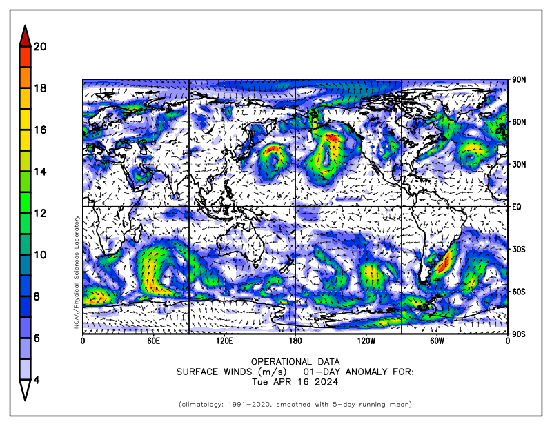
http://www.cdc.noaa.gov/map/images/fnl/sfcwnd_07a.fnl.gif
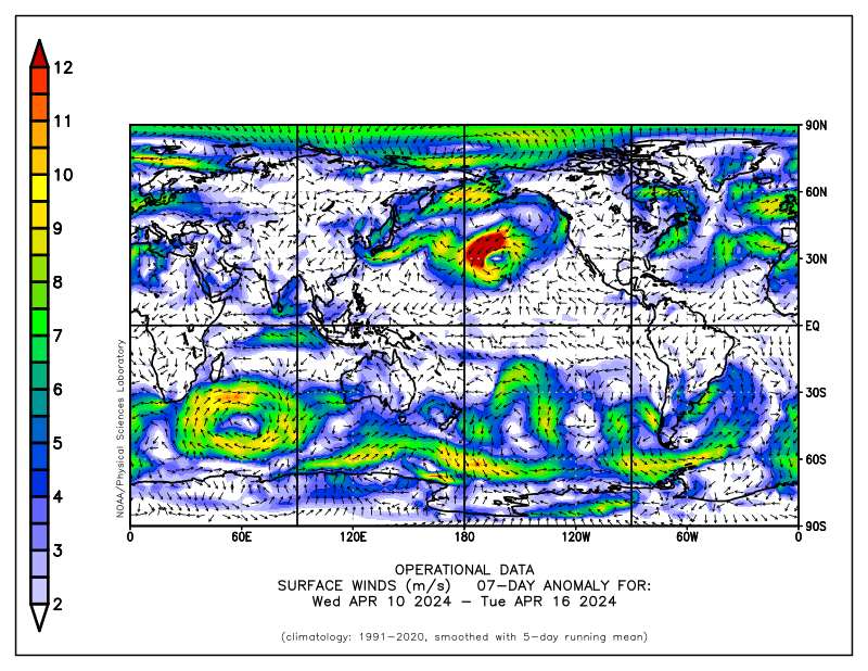
The link below goes to an experimental model for predictions of tropical Indo-Pacific SSTs. What is interesting is that the model is run in real-time (details on the web page). Whatever the case may be, uncertainty about the future course of ENSO is very high, particularly during boreal spring (so-called spring barrier of predictability). Let us just see what really happens.
http://www.bom.gov.au/bmrc/ocean/JAFOOS/POAMA/exproducts/poama_v10/fc_rt_nino_l30.htm
During the last ~5 days the tropical convective forcing has become less coherent, with even a signal of a convectively coupled Kevin wave moving well into the WH as I type. Per full disk satellite imagery, the main region of tropical convection extended from southeast Asia/northwest Indonesia east-southeast across northern Australia into the South Pacific Ocean. Other transient flare-ups were occurring across northern South America and central Africa. Any MJO signal is very weak (see below).
http://www.bom.gov.au/bmrc/clfor/cfstaff/matw/maproom/OLR/m.3d.html
http://www.bom.gov.au/bmrc/clfor/cfstaff/matw/maproom/RMM/phase.Last90days.gif
http://www.ssec.wisc.edu/data/geo/mtsat/
An important point is that upper tropospheric westerly wind anomalies have appeared across tropical Africa and the IO, where easterlies were present about a week ago. Westerly flow has been generally increasing throughout the tropical and subtropical atmospheres for the past couple of weeks or so, with 200mb zonal mean anomalies ~5 m/s. This can all be attributed to convective event#3 discussed above, and a consequence we are now seeing is that the EAJ is extending into the North Pacific with 250mb anomalies ~20-30 m/s. This jet is being directed in an anticyclonically curved manner across our now familar central Pacific ridge and will impact the west coast of the USA during the next few days. Meanwhile, zonal mean easterly anomalies continue across the Arctic, suggesting more split flow for North America. Please see the link below to study some animations of various fields.
http://www.cdc.noaa.gov/map/clim/glbcir.anim.shtml
Global relative AAM is still ~2 standard deviations below the 1979-1998 climatology, due to anomalous easterly flow throughout the tropical and subtropical regions (vertically and zonally averaged). Punch line is that SDM Stage 2 may now best describe the circulation at least for the tropics and subtropics, with complex interactions outside the tropics given our La-Nina base state. Hovmoller presentations of numerous fields suggest the atmosphere started to persist in a SDM Stage 1 regime beginning about the middle of February, with perhaps a subtle change to SDM Stage 2 about a week-10 days ago. If this is indeed the case, that would go well with discussions in previous Blog postings.
http://www.cdc.noaa.gov/map/images/aam/glaam.gif
For the PNA sector that would support a stronger than climatology North Pacific jet (over the ridge) with troughs penetrating inland into the western USA instead of first digging off the coast. This would be in the presence of split flow with "lots of high pressure" particularly over eastern Canada into the North Atlantic (which may continue a negative projection onto the NAO). Ensemble numerical models such as from CDC, NCEP and CMC have been trending toward this notion for the past week. While the details are unclear, I think that direction is reasonable. I think at some point we may see a full-latitude ridge develop just off the North American west coast, possibly toward the end of week 2 (I have my reasons).
This all translates to a continuation of a very active weather pattern for the CONUS for at least the next 2 weeks. In fact, perhaps even more so for the Rockies and Plains. Additionally, if there is any truth to La-Nina weakening, I could see more transient strong western USA troughs for several more weeks. By now, everyone should understand the potentially high impact weather events from all this.
For southwest Kansas, it all comes down to the tracks of each baroclinically developing trough whether we get storms, southwest wind heat and dust storms, both, etc. I have some optimism (not wishing for damage, etc.) for rain/storms around the end of next week/weekend. In general, I would think there will be opportunities for thunderstorms at least ahead of the drylines. As usual, better opportunities for precipitation will be to our east and north. Both temperatures and probably the surface wind will average above normal for at least the next two weeks.
I will try to post another (hopefully shorter) update around the middle of next week.
Ed Berry
Wednesday, April 05, 2006
Brief Update
Since I am on travel much of this week, my next posting with real substance will have to wait until this upcoming weekend. What I wrote on April 2 is still very much relevant.
Tropical convective forcing appears to be stalling again around 130-140E just south of the equator (centroid). The circulation response continues to be SDM Stage 1, and it is probable that will persist for at least the next 2 weeks. Given the blocking structures across the north polar latitudes, most of the CONUS would be expected to see active weather (details given in past postings).
Same story for southwest Kansas. It is interesting that the storm currently progressing into the western states looks to track farther south than many earlier model runs were predicting. The deterministic ECMWF has been performing quite well with our current ciculation regime for at least the past 1-2 weeks.
Ed Berry
Sunday, April 02, 2006
Maybe Some Slight Sub-seaonal Changes
In my past postings I have provided links to SST information, plots of OLR and OLRA, AAM, NWP models, animations to various fields, etc. Please refer to them. The purpose of this writing is to update my March 29th posting, and I do need to keep this relatively brief.
There do appear to be some slight changes, at least on the subseasonal time scale, occurring as I type. These include:
1. The below normal SSTs ~minus 0.5-1.5C along the equatorial cold tongue region have been shifting east for at least the past 2-4 weeks. Additionally, actual SSTs of at least 28C have also propagated east to ~160W along the equator during this period. This behavior may be tied to the seasonal cycle, and also suggests our cold event may be starting to decay. The latter would be consistent with several dynamical and statistical tools which suggest ENSO may become at least neutral in ~ 6 months. However, that needs to be monitored, and where the tropical Pacific SSTs go from here is still unclear. For our purposes, warmer SSTs shifting east may also allow EH tropical convective forcing to also once again move into regions such as the west central Pacific;
2. There has been a consolidation (flare-up) of very intense (OLRA ~minus 70 w/m**2 and lower) tropical convective forcing ~10S/120-140E during the last 3-5 days. An eastward moving component from the IO has been a contributor, and a back of the envelope calculation gives a phase speed of about 4-5 m/s (~3-4 deg long/day). At this time the centroid is at about 140E, and may, in fact, contain at least a weak MJO component. Indices such as the Wheeler plot and time-filtered OLR/OLRA Hovmoller plots lend some support to that notion. In any case, to me what we are seeing is at least another 20-30 day mode of tropical convective variability, and this will impact the weather for the USA for at least both weeks 1 and 2;
3. SDM Stage 1 still rules, with global relative AAM ~2 standard deviations below the 1979-1996 climatology. Anomalous vertically averaged zonal mean easterly flow continues throughout the subtropical atmosphere, particularly south of the equator. Anomalous zonal mean easterly flow across the north polar latitudes has lead to a southward displaced storm track across the CONUS (and some split flow) with STJ interactions, contributing to the recent active weather pattern for the past 3 weeks; and,
4. Several monitoring aids including Hovmoller plots of upper tropospheric winds verify that our stationary SDM Stage 1 regime has persisted for at least the last 4-6 weeks. Again, tied to the tropical convective forcing currently moving east and also the seasonal cycle, this pattern looks to shift ~10 deg to the east by week 2. This matter was already discussed in my previous posting. Whether or not we SDM Stage 2 by late week 2 or 3 is unclear. However, at least for weeks 1-2, the recent pattern of troughs first digging into eastern Pacific and then getting kicked inland looks to change. Similar to what what observed about 3 weeks ago (~March 11-12, after an eastward shift of the IO/Indo convection at at that time), I think there exists a decent possibility of at least 1-2 strong troughs digging more into the western Rockies perhaps starting as early as next weekend. Indeed, models such as the NCEP ensemble and even the 1200 UTC 2 April ECMWF are starting to suggest this. Again, details are unclear and any predictive information beyond day 3 in a regime as complicated as this one must be expressed probabilistically. Consequences may include more strong baroclinic cyclogenesis across the Plains with all sorts of high-impact weather.
I think everyone knows the "weather consequences" of our active regime by now. For week 1, I like the trend of the recent model runs slowing down the eastward movement of our next western and central USA trough/baroclinic development. I can link this week 1 development directly to a current fast Rossby wave energy dispersion (RWD) due to the 140E tropical forcing. The models are playing catch up as the impacts from this RWD become better sampled into their initial conditions. Once this storm system emerges from the Rockies by about this coming Thursday, the ECMWF solution of a closed low moving to east across the central USA south of high pressure across Canada is reasonable.
As active as week 1 may be for much of the USA, week 2 may be even more so. Going along with climatology with some enhancement, storm season across much of the central part of the country may get down to some "real serious business". Initially the west coast would get the weather impacts, with progression through the Rockies and then emergence out into the Plains. The Ohio/Tennesse Valleys would also be affected. Places like the southeast states may have an early start to summer.
The beat goes on for southwest Kansas. Fortunately much needed precipitation has been occurring for about the past couple of weeks. Troughs landing initially in the east Pacific instead of the western states have helped, allowing an opportunity for some decent moisture transport this far west from the Gulf of Mexico (and tropics). I think there will be another chance roughly Wednesday night and Thursday. However, we will have to watch out for the dry intrusion/mixing down of the EML. Most substantial precipitation will continue to be to our east and north. Starting next weekend through the following weekend, our best opportunities for precipitation may be just ahead of the dry slots/dry lines since there should be rapid moisture returns. However, there may be a higher probability of one or two events featuring "southwest winds and blowing dust" similar to what we saw March 12th (understanding we now have better soil moisture). Warmer than normal temperatures are likely for at least the next couple of weeks, which should include at least a few days with highs well into the 80s and minimums in the 50s to lower 60s.
I will be on travel much of this upcoming week. I will try to do another posting about mid-week.
Ed Berry
Subscribe to:
Posts (Atom)